Vereinigte Staaten von Amerika | Death Valley National Park
03.04.2010 | Kalifornien - Death Valley National Park und Umgebung
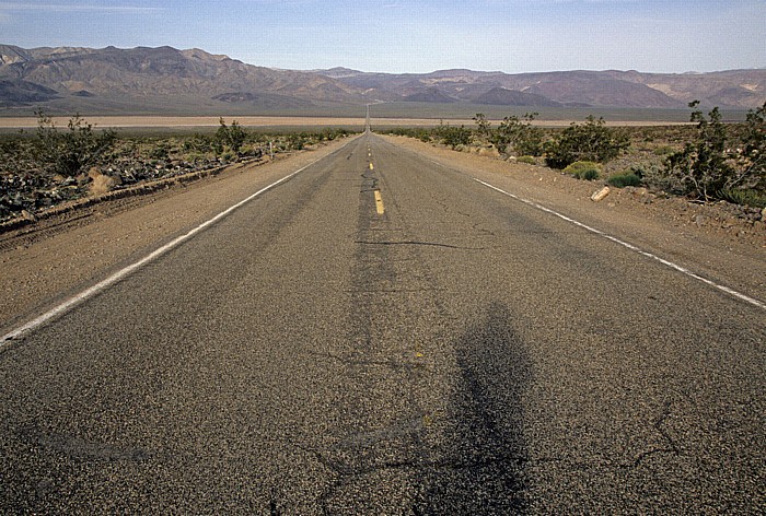
Panamint Valley (Mojave Desert): California State Route 190
Im Hintergrund die Panamint Range.
03.04.2010 | Kalifornien - Death Valley National Park und Umgebung
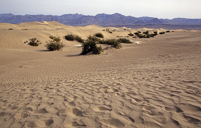
Death Valley: Dünen in der Nähe von Stovepipe Wells
Im Hintergrund die Amargosa Range.
| Amargosa Range | Death Valley |
03.04.2010 | Kalifornien - Death Valley National Park und Umgebung
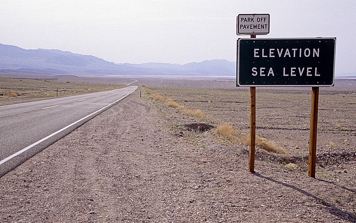
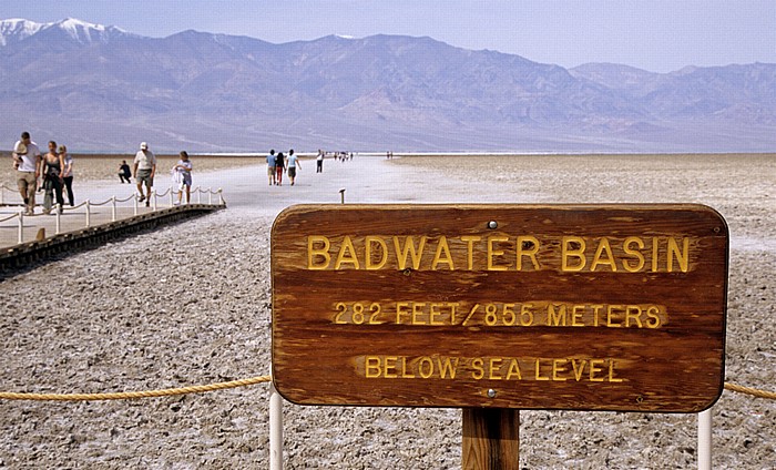
Death Valley (Mojave Desert): Meeresspiegel
Das sich dem Schild anschließende Gebiet liegt unter dem Meeresspiegel.
| Death Valley |
03.04.2010 | Kalifornien - Death Valley National Park und Umgebung
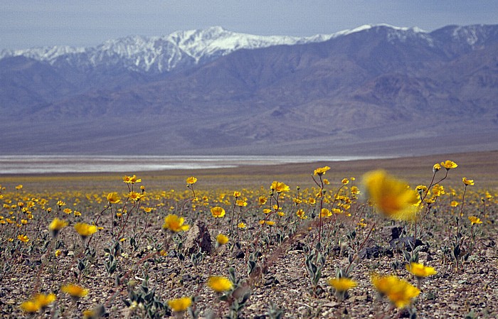
Death Valley (Mojave Desert)
Im Hintergrund die Panamint Range mit dem Telescope Peak.
| Death Valley | Panamint Range | Telescope Peak |
03.04.2010 | Kalifornien - Death Valley National Park und Umgebung
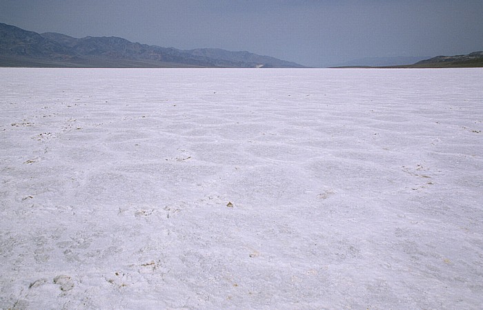
Death Valley (Mojave Desert): Devil’s Golf Course
03.04.2010 | Kalifornien - Death Valley National Park und Umgebung
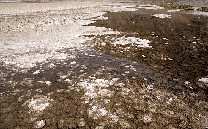
Death Valley (Mojave Desert): Badwater
| Badwater | Death Valley |
03.04.2010 | Kalifornien - Death Valley National Park und Umgebung
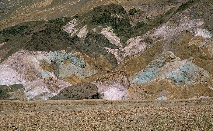
Amargosa Range (Black Mountains): Artists Palette
03.04.2010 | Kalifornien - Death Valley National Park und Umgebung
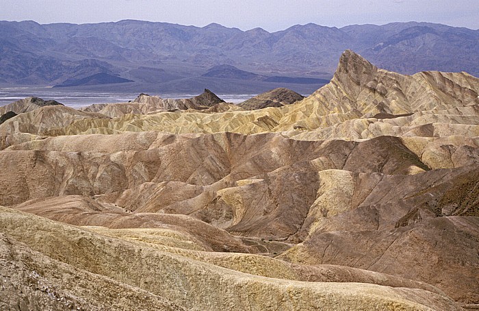
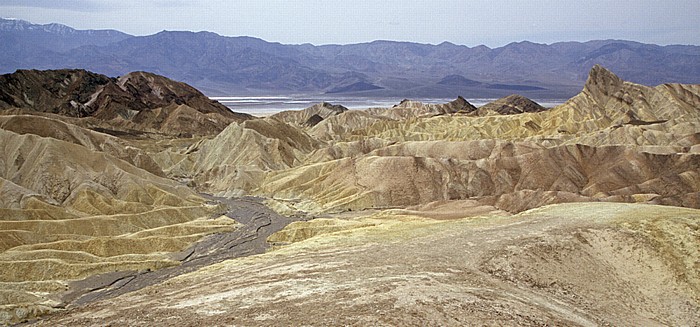
Amargosa Range: Zabriskie Point
Im Hintergrund das Death Valley und die Panamint Range.
| Amargosa Range | Death Valley | Panamint Range | Zabriskie Point |
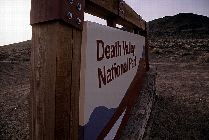
03.04.2010 | Kalifornien - Death Valley National Park und Umgebung
Parkeingang
03.04.2010 | Kalifornien - Death Valley National Park und Umgebung
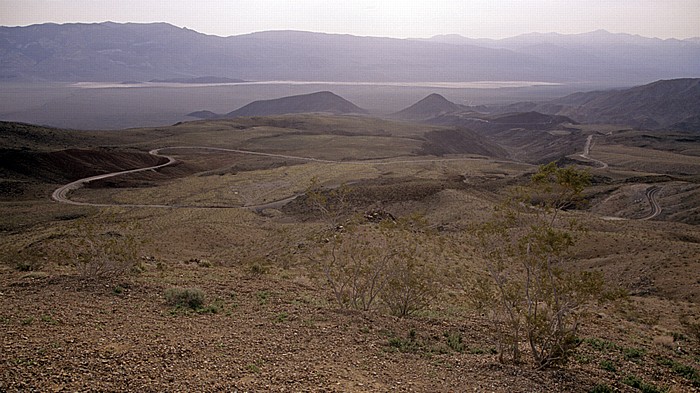
Blick von der Argus Range: Panamint Valley (Mojave Desert) mit California State Route 190
Im Hintergrund die Panamint Range.
| Argus Range | Panamint Range | Panamint Valley |
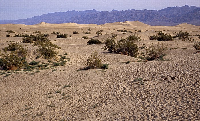
03.04.2010 | Kalifornien - Death Valley National Park und Umgebung
Death Valley: Dünen in der Nähe von Stovepipe Wells
Im Hintergrund die Amargosa Range.
| Amargosa Range | Death Valley |
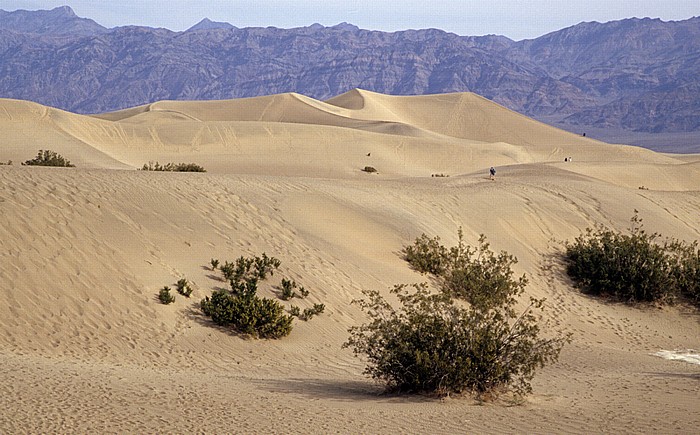
03.04.2010 | Kalifornien - Death Valley National Park und Umgebung
Death Valley: Dünen in der Nähe von Stovepipe Wells
Im Hintergrund die Amargosa Range.
| Amargosa Range | Death Valley |
03.04.2010 | Kalifornien - Death Valley National Park und Umgebung
Death Valley: Dünen in der Nähe von Stovepipe Wells
Im Hintergrund die Amargosa Range.
| Amargosa Range | Death Valley |
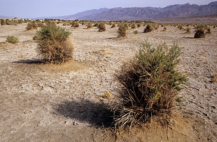
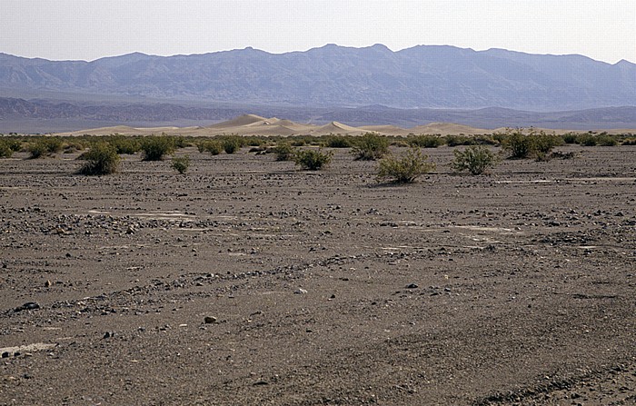
03.04.2010 | Kalifornien - Death Valley National Park und Umgebung
Death Valley: Devil's Corn Field
Im Hintergrund die Amargosa Range.
03.04.2010 | Kalifornien - Death Valley National Park und Umgebung
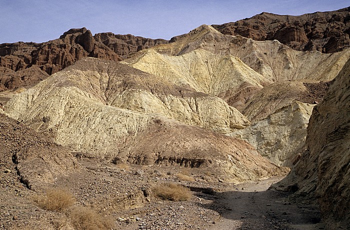
Amargosa Range: Golden Canyon
| Amargosa Range | Golden Canyon |
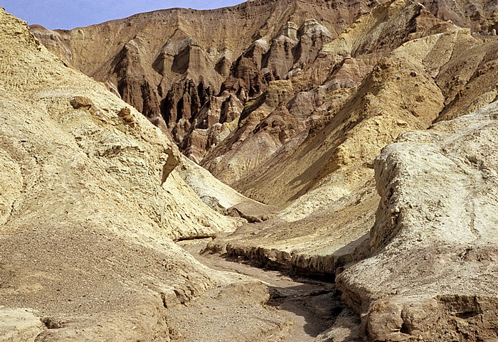
03.04.2010 | Kalifornien - Death Valley National Park und Umgebung
Amargosa Range: Golden Canyon
| Amargosa Range | Golden Canyon |
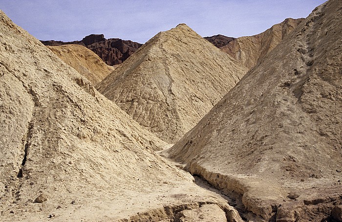
03.04.2010 | Kalifornien - Death Valley National Park und Umgebung
Amargosa Range: Golden Canyon
| Amargosa Range | Golden Canyon |
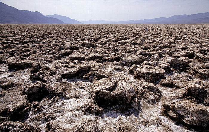
03.04.2010 | Kalifornien - Death Valley National Park und Umgebung
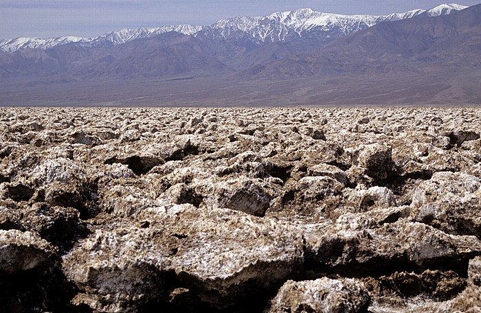
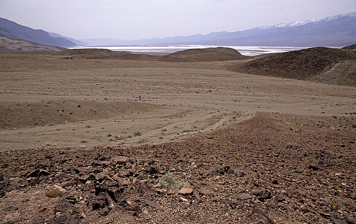
Death Valley (Mojave Desert): Devil’s Golf Course
Im Hintergrund die Panamint Range mit dem Telescope Peak.
| Death Valley | Devil’s Golf Course | Panamint Range | Telescope Peak |
03.04.2010 | Kalifornien - Death Valley National Park und Umgebung
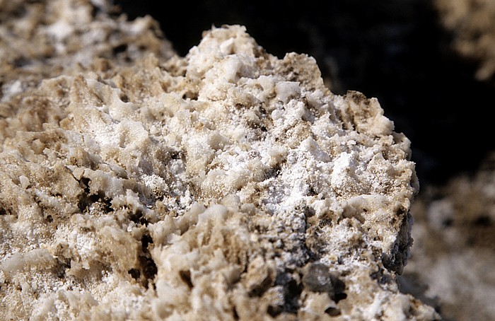
Death Valley (Mojave Desert): Devil’s Golf Course
03.04.2010 | Kalifornien - Death Valley National Park und Umgebung
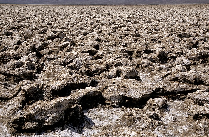
Death Valley (Mojave Desert): Devil’s Golf Course
03.04.2010 | Kalifornien - Death Valley National Park und Umgebung
Blick von der Amargosa Range (Black Mountains): Death Valley
Im Hintergrund die Panamint Range.
03.04.2010 | Kalifornien - Death Valley National Park und Umgebung
Death Valley (Mojave Desert): Badwater
Im Hintergrund die Panamint Range.
| Badwater | Death Valley | Panamint Range |
03.04.2010 | Kalifornien - Death Valley National Park und Umgebung
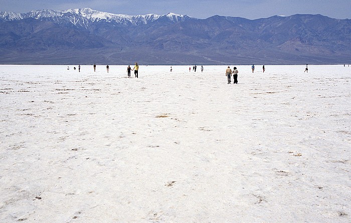
Death Valley (Mojave Desert): Badwater
| Badwater | Death Valley |
03.04.2010 | Kalifornien - Death Valley National Park und Umgebung
Death Valley (Mojave Desert): Badwater
Im Hintergrund die Panamint Range mit dem Telescope Peak.
| Badwater | Death Valley | Panamint Range | Telescope Peak |
03.04.2010 | Kalifornien - Death Valley National Park und Umgebung
Amargosa Range: Zabriskie Point
Im Hintergrund das Death Valley und die Panamint Range.
| Amargosa Range | Death Valley | Panamint Range | Zabriskie Point |
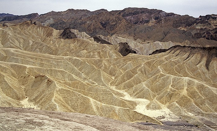
03.04.2010 | Kalifornien - Death Valley National Park und Umgebung
Amargosa Range: Zabriskie Point
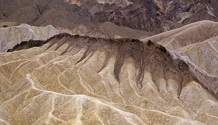
03.04.2010 | Kalifornien - Death Valley National Park und Umgebung
Amargosa Range: Zabriskie Point