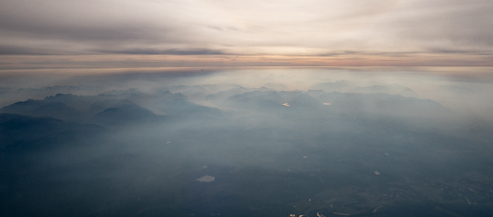
Luftbilder | Washington
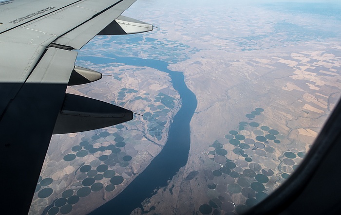
25.08.2017 | 2017 | Flug Salt Lake City - Seattle
Benton County (Washington) / Columbia River / Umatilla County (Oregon)
Flug Salt Lake City - Seattle. Luftbild.
| Flug DAL1873 Salt Lake City (KSLC) - Seattle/Tacoma (KSEA) | Benton County | Columbia River |
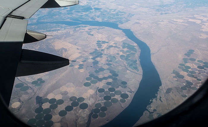
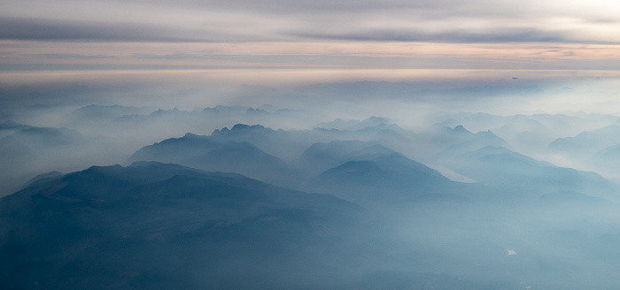
25.08.2017 | 2017 | Flug Salt Lake City - Seattle
Benton County (Washington) / Columbia River / Umatilla County (Oregon)
Links oben Kennewick. Flug Salt Lake City - Seattle. Luftbild.
| Flug DAL1873 Salt Lake City (KSLC) - Seattle/Tacoma (KSEA) | Benton County | Columbia River | Kennewick |
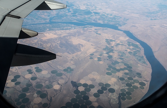
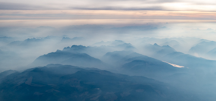
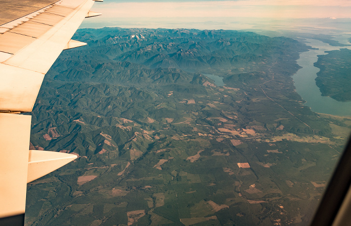
25.08.2017 | 2017 | Flug Salt Lake City - Seattle
Benton County (Washington) / Columbia River / Umatilla County (Oregon)
Links oben Kennewick. Flug Salt Lake City - Seattle. Luftbild.
| Flug DAL1873 Salt Lake City (KSLC) - Seattle/Tacoma (KSEA) | Benton County | Columbia River | Kennewick |
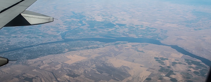
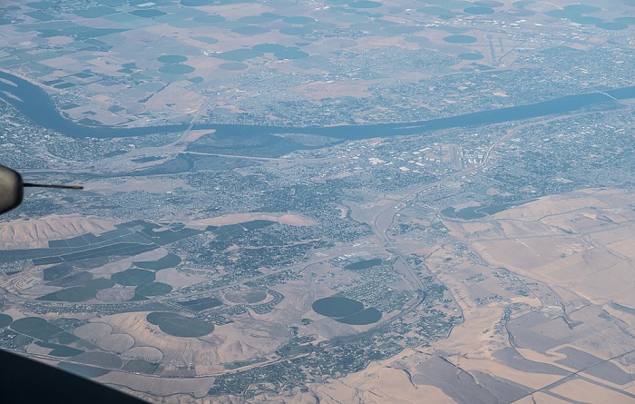
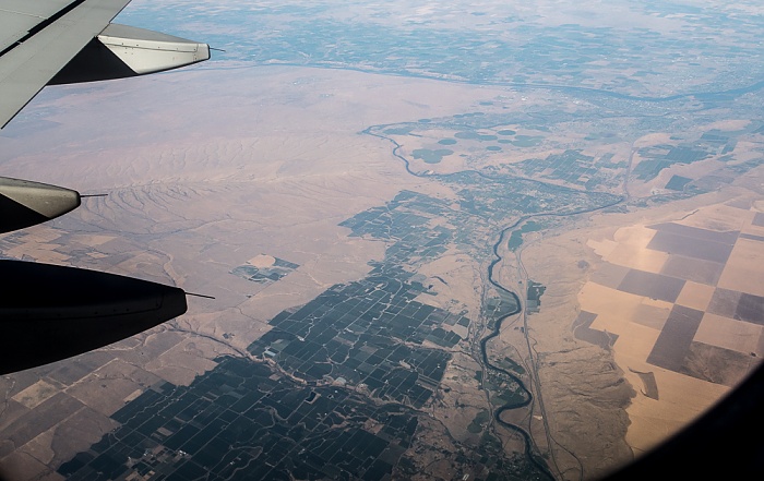
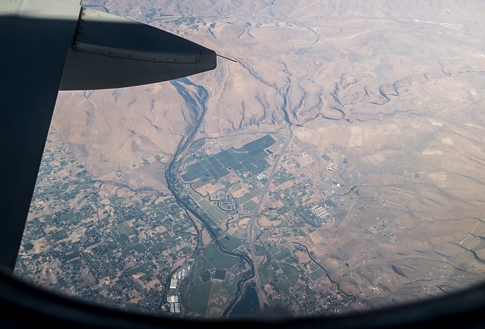
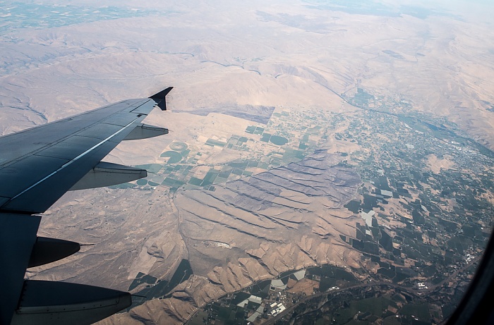
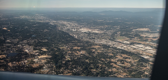
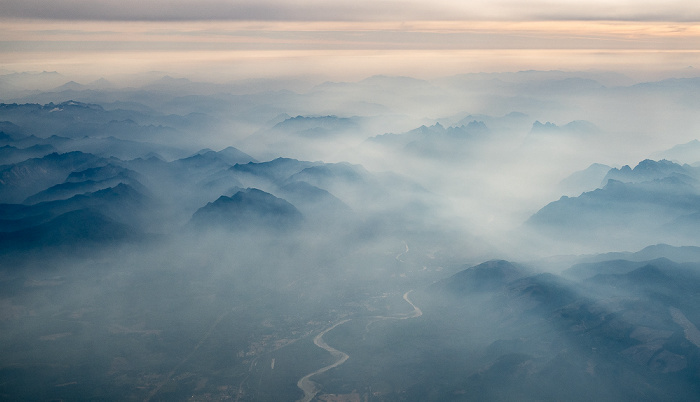
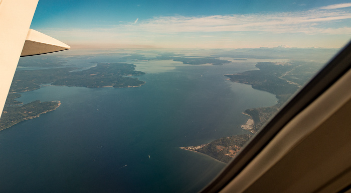
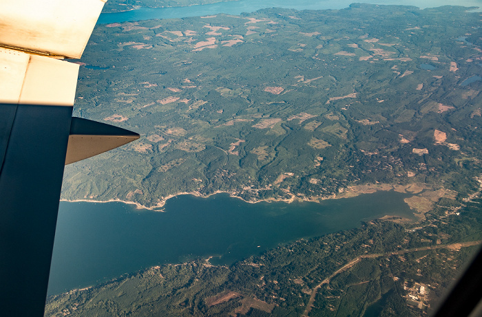
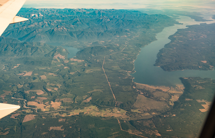
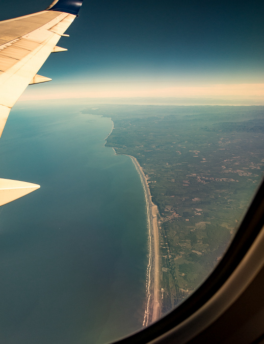
25.08.2017 | 2017 | Flug Salt Lake City - Seattle
V.u.: Benton County mit Kennewick / Columbia River / Franklin County mit Pasco
Flug Salt Lake City - Seattle. Luftbild.
| Flug DAL1873 Salt Lake City (KSLC) - Seattle/Tacoma (KSEA) | Benton County | Columbia River | Franklin County | Kennewick | Pasco |
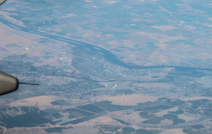
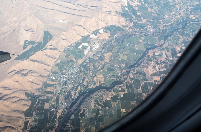
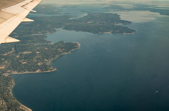
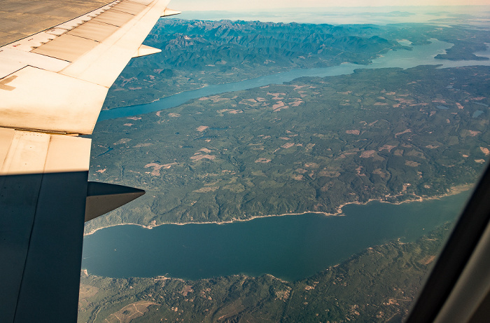
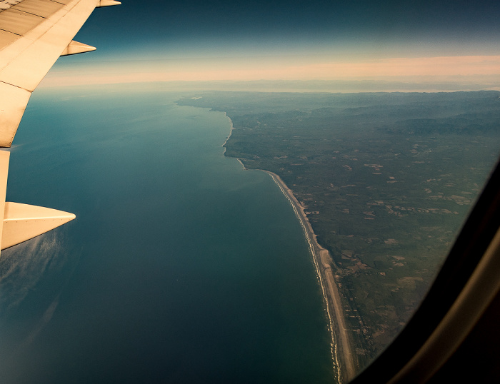
25.08.2017 | 2017 | Flug Salt Lake City - Seattle
V.u.: Benton County mit Richland (links) und Kennewick / Columbia River / Franklin County mit Pasco
Flug Salt Lake City - Seattle. Luftbild.
| Flug DAL1873 Salt Lake City (KSLC) - Seattle/Tacoma (KSEA) | Benton County | Columbia River | Franklin County | Kennewick | Pasco | Richland |
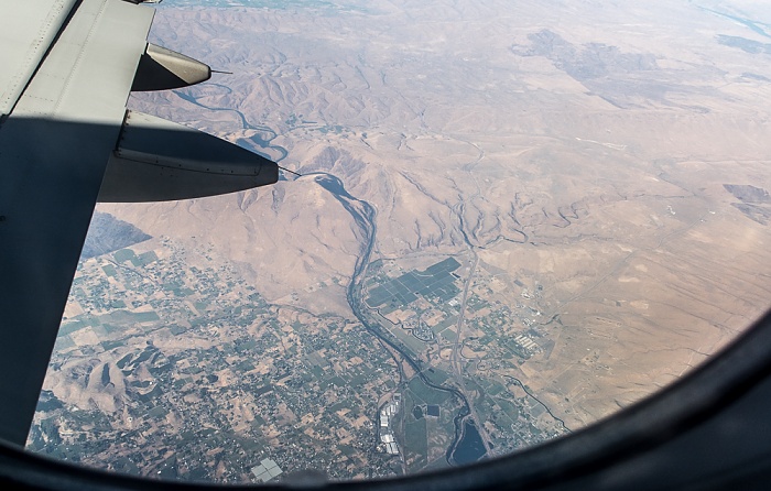
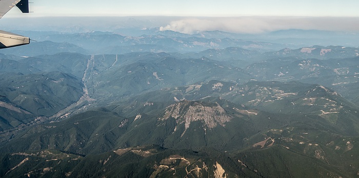
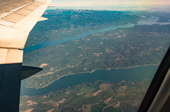
25.08.2017 | 2017 | Flug Salt Lake City - Seattle
V.u.: Benton County mit Richland / Columbia River / Franklin County
Flug Salt Lake City - Seattle. Luftbild.
| Flug DAL1873 Salt Lake City (KSLC) - Seattle/Tacoma (KSEA) | Benton County | Columbia River | Franklin County | Richland |
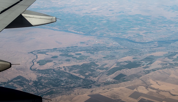
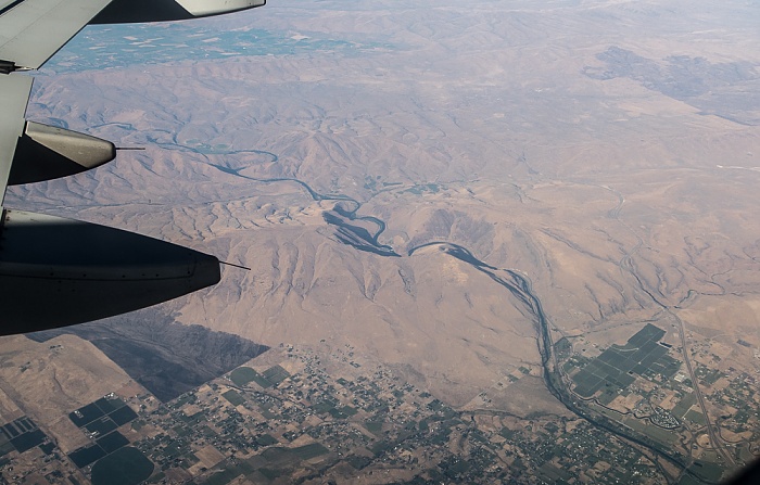
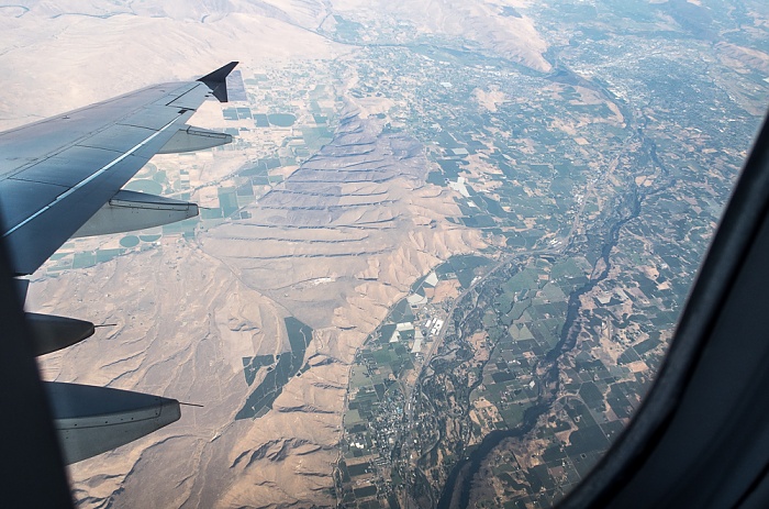
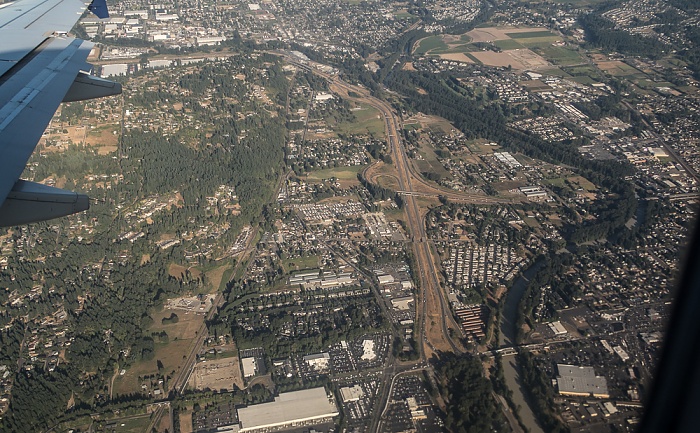
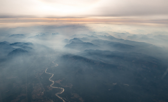
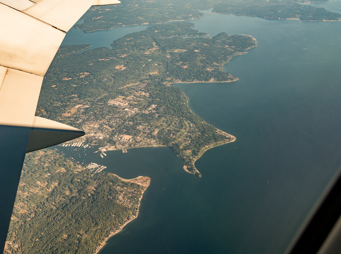
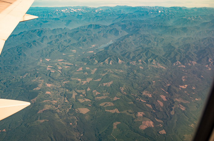
25.08.2017 | 2017 | Flug Salt Lake City - Seattle
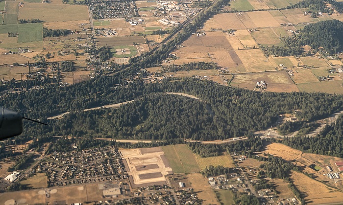
Benton County: Yakima River
Oben der Columbia River und Franklin County. Flug Salt Lake City - Seattle. Luftbild.
| Flug DAL1873 Salt Lake City (KSLC) - Seattle/Tacoma (KSEA) | Benton County | Columbia River | Franklin County | Yakima River |
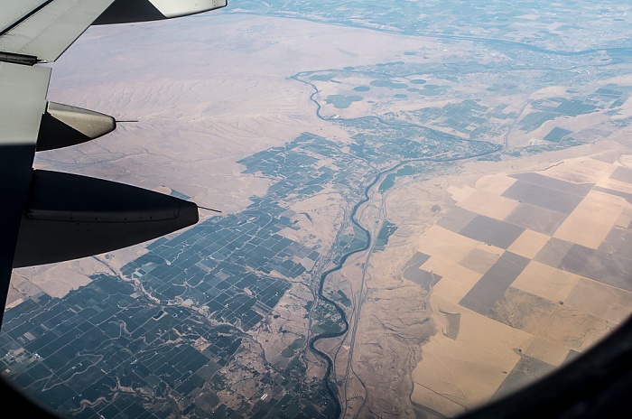
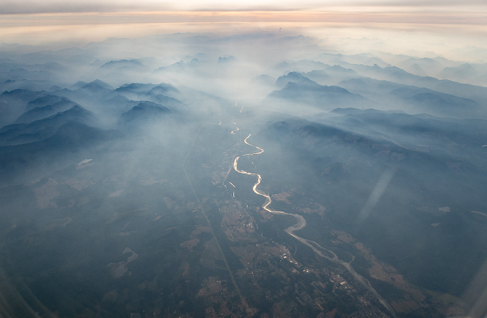
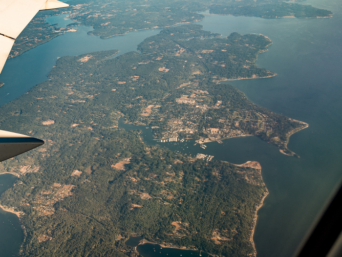
25.08.2017 | 2017 | Flug Salt Lake City - Seattle
Benton County: Yakima River
Oben der Columbia River und Franklin County. Flug Salt Lake City - Seattle. Luftbild.
| Flug DAL1873 Salt Lake City (KSLC) - Seattle/Tacoma (KSEA) | Benton County | Columbia River | Franklin County | Yakima River |
25.08.2017 | 2017 | Flug Salt Lake City - Seattle
Benton County: Yakima River
Oben der Columbia River und Franklin County. Flug Salt Lake City - Seattle. Luftbild.
| Flug DAL1873 Salt Lake City (KSLC) - Seattle/Tacoma (KSEA) | Benton County | Columbia River | Franklin County | Yakima River |
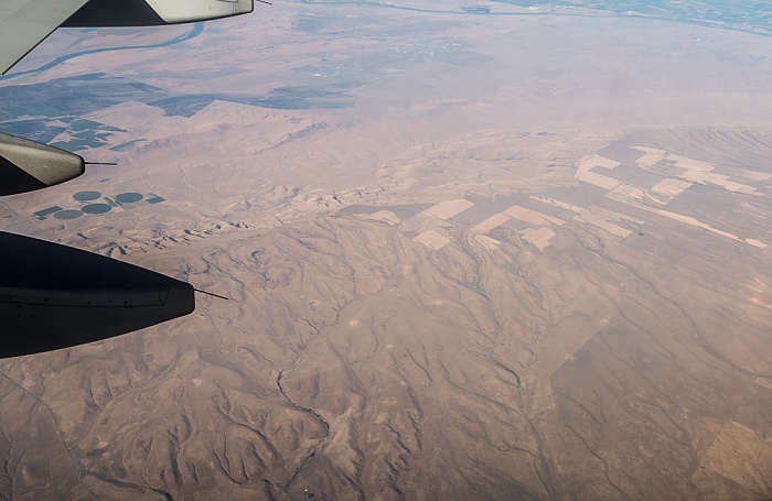
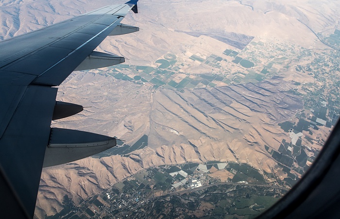
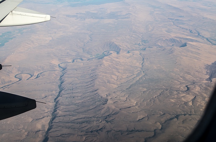
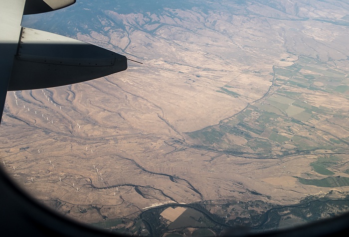
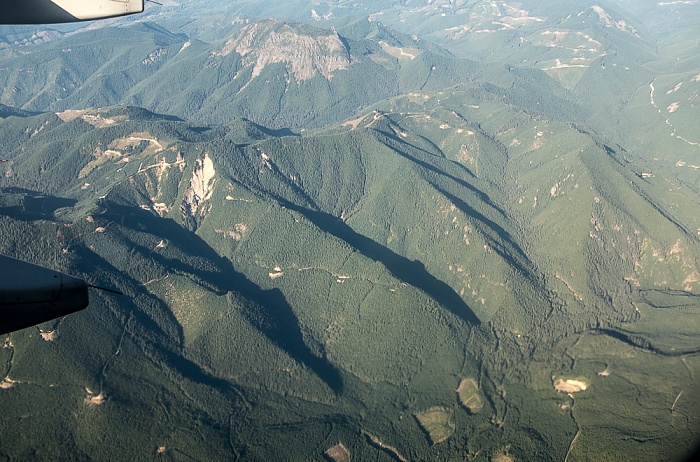
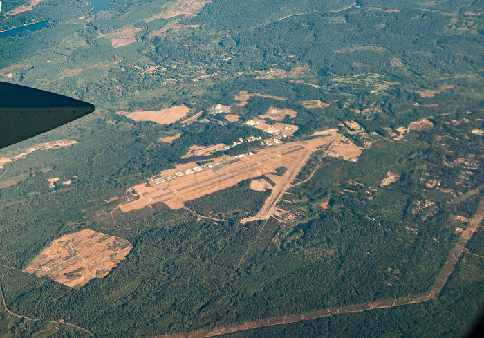
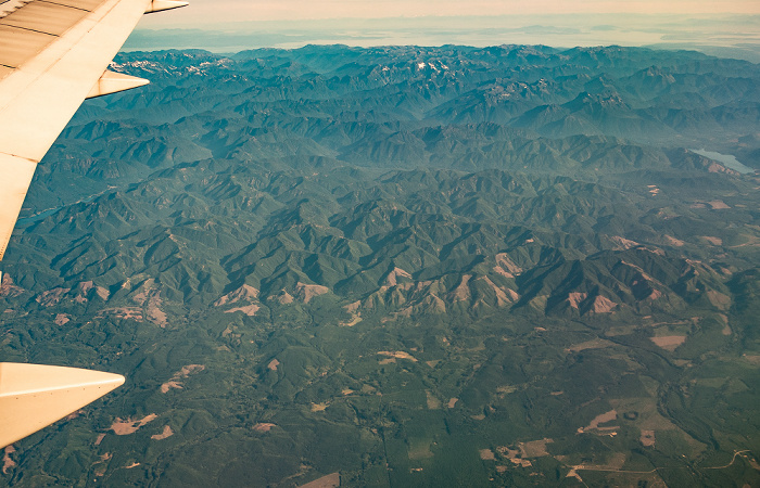
25.08.2017 | 2017 | Flug Salt Lake City - Seattle
Benton County
Links oben der Columbia River. Flug Salt Lake City - Seattle. Luftbild.
| Flug DAL1873 Salt Lake City (KSLC) - Seattle/Tacoma (KSEA) | Benton County | Columbia River |
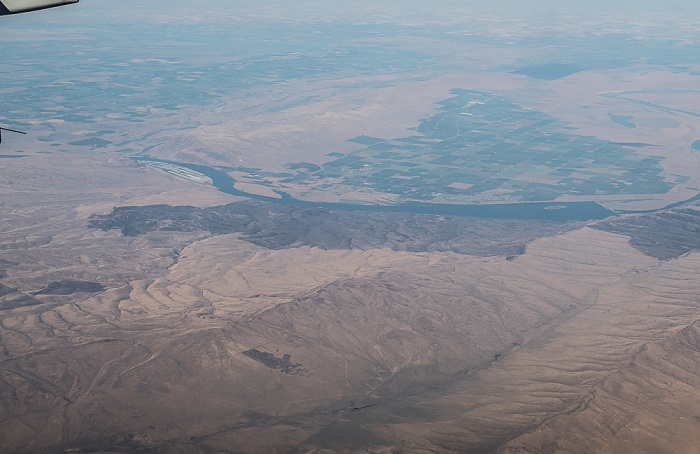
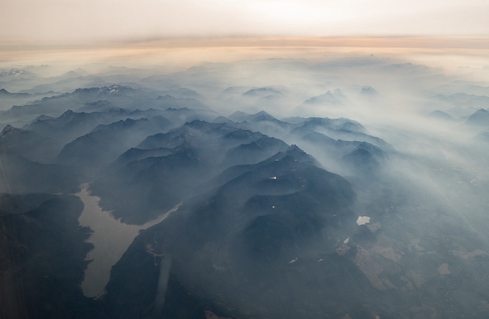
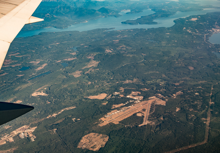
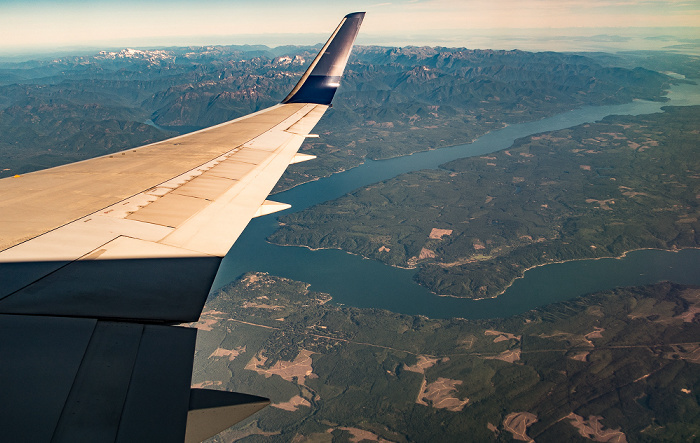
25.08.2017 | 2017 | Flug Salt Lake City - Seattle
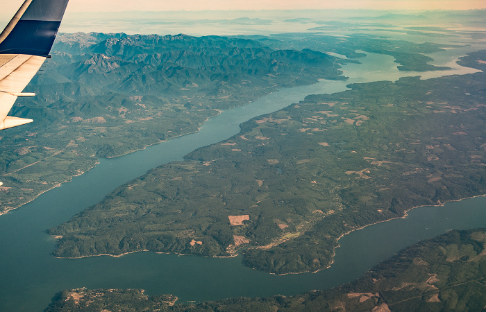
V.u.: Yakima County / Columbia River mit der Goose Island (Priest Rapids Wildlife Area) und dem Priest Rapids Dam / Grant County
Flug Salt Lake City - Seattle. Luftbild.
| Flug DAL1873 Salt Lake City (KSLC) - Seattle/Tacoma (KSEA) | Columbia River | Goose Island | Grant County | Priest Rapids Dam | Priest Rapids Wildlife Area | Yakima County |
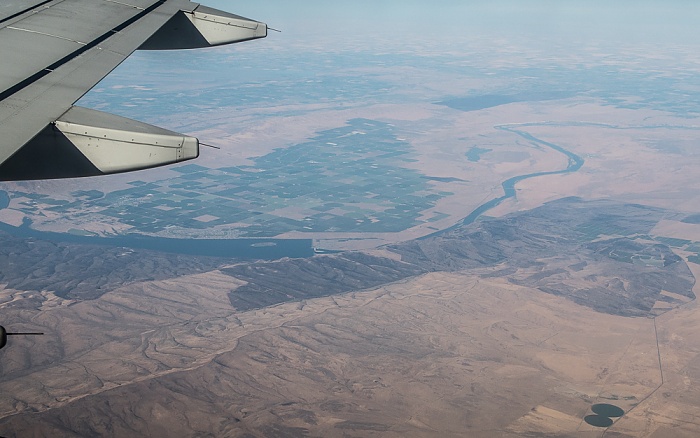
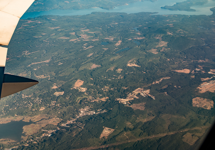
25.08.2017 | 2017 | Flug Salt Lake City - Seattle
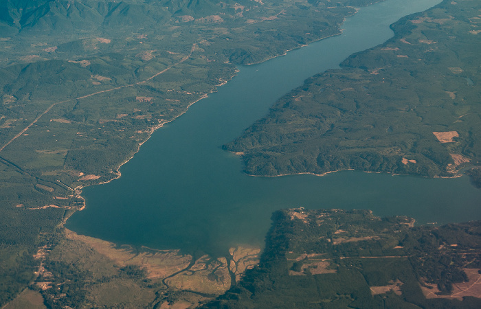
V.u.: Yakima County / Columbia River / Grant County
Rechts in der Bildmitte Goose Island (Priest Rapids Wildlife Area) und der Priest Rapids Dam. Flug Salt Lake City - Seattle. Luftbild.
| Flug DAL1873 Salt Lake City (KSLC) - Seattle/Tacoma (KSEA) | Columbia River | Goose Island | Grant County | Priest Rapids Dam | Priest Rapids Wildlife Area | Yakima County |
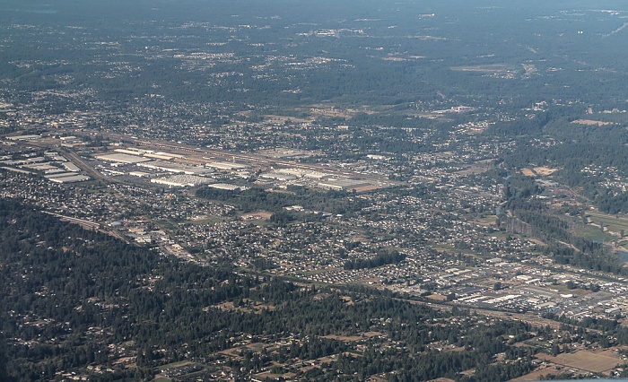
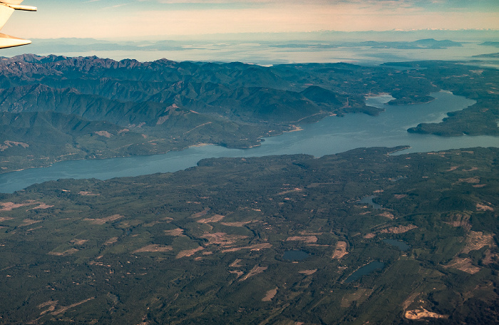
25.08.2017 | 2017 | Flug Salt Lake City - Seattle
Yakima County: Selah, Yakima River
Unten in der Bildmitte die Zirkle Fruit Company. Flug Salt Lake City - Seattle. Luftbild.
| Flug DAL1873 Salt Lake City (KSLC) - Seattle/Tacoma (KSEA) | Selah | Yakima County | Zirkle Fruit Company |
25.08.2017 | 2017 | Flug Salt Lake City - Seattle
Yakima County: Selah, Yakima River
Unten in der Bildmitte die Zirkle Fruit Company. Flug Salt Lake City - Seattle. Luftbild.
| Flug DAL1873 Salt Lake City (KSLC) - Seattle/Tacoma (KSEA) | Selah | Yakima County | Zirkle Fruit Company |
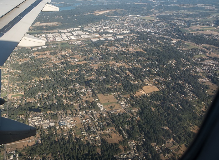
25.08.2017 | 2017 | Flug Salt Lake City - Seattle
Yakima County: Selah, Yakima River
Flug Salt Lake City - Seattle. Luftbild.
| Flug DAL1873 Salt Lake City (KSLC) - Seattle/Tacoma (KSEA) | Selah | Yakima County |
25.08.2017 | 2017 | Flug Salt Lake City - Seattle
Yakima County: Naches River
Flug Salt Lake City - Seattle. Luftbild.
| Flug DAL1873 Salt Lake City (KSLC) - Seattle/Tacoma (KSEA) | Naches River | Yakima County |
25.08.2017 | 2017 | Flug Salt Lake City - Seattle
Yakima County: Naches River
Oben der Yakima River. Flug Salt Lake City - Seattle. Luftbild.
| Flug DAL1873 Salt Lake City (KSLC) - Seattle/Tacoma (KSEA) | Naches River | Yakima County |
25.08.2017 | 2017 | Flug Salt Lake City - Seattle
Yakima County: Naches, Naches River
Flug Salt Lake City - Seattle. Luftbild.
| Flug DAL1873 Salt Lake City (KSLC) - Seattle/Tacoma (KSEA) | Naches | Naches River | Yakima County |
25.08.2017 | 2017 | Flug Salt Lake City - Seattle
Yakima County: Naches, Naches River
Oben der Yakima River. Flug Salt Lake City - Seattle. Luftbild.
| Flug DAL1873 Salt Lake City (KSLC) - Seattle/Tacoma (KSEA) |
25.08.2017 | 2017 | Flug Salt Lake City - Seattle
Yakima County: Umtanum Creek
Oben der Yakima River. Flug Salt Lake City - Seattle. Luftbild.
| Flug DAL1873 Salt Lake City (KSLC) - Seattle/Tacoma (KSEA) | Umtanum Creek | Yakima County | Yakima River |
25.08.2017 | 2017 | Flug Salt Lake City - Seattle
Kittitas County
Flug Salt Lake City - Seattle. Luftbild.
| Flug DAL1873 Salt Lake City (KSLC) - Seattle/Tacoma (KSEA) | Kittitas County |
25.08.2017 | 2017 | Flug Salt Lake City - Seattle
Kittitas County: Interstate I-90 (American Veterans Memorial Highway), Yakima River
Flug Salt Lake City - Seattle. Luftbild.
| Flug DAL1873 Salt Lake City (KSLC) - Seattle/Tacoma (KSEA) | Interstate I-90 (American Veterans Memorial Highway) | Kittitas County | Yakima River |
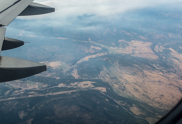
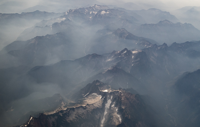
25.08.2017 | 2017 | Flug Salt Lake City - Seattle
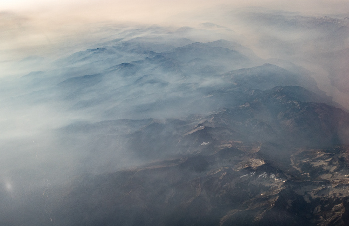
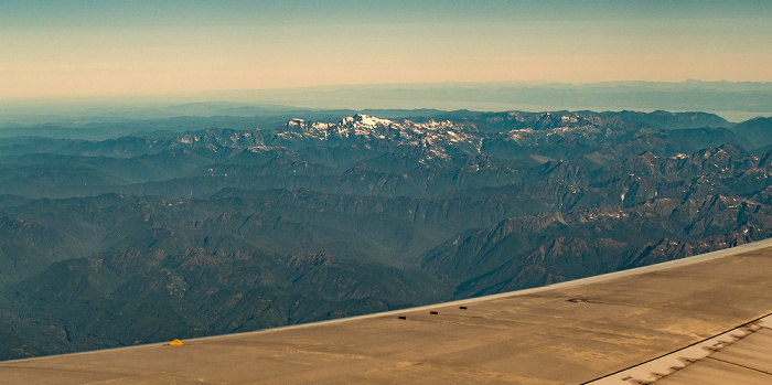
Kittitas County: Cascade Range (Kaskadenkette)
Flug Salt Lake City - Seattle. Luftbild.
| Flug DAL1873 Salt Lake City (KSLC) - Seattle/Tacoma (KSEA) | Cascade Range (Kaskadenkette) | Kittitas County |
25.08.2017 | 2017 | Flug Salt Lake City - Seattle
Kittitas County: Cascade Range (Kaskadenkette)
Flug Salt Lake City - Seattle. Luftbild.
| Flug DAL1873 Salt Lake City (KSLC) - Seattle/Tacoma (KSEA) | Cascade Range (Kaskadenkette) | Kittitas County |
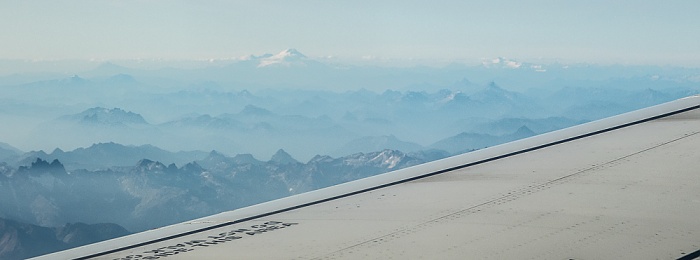
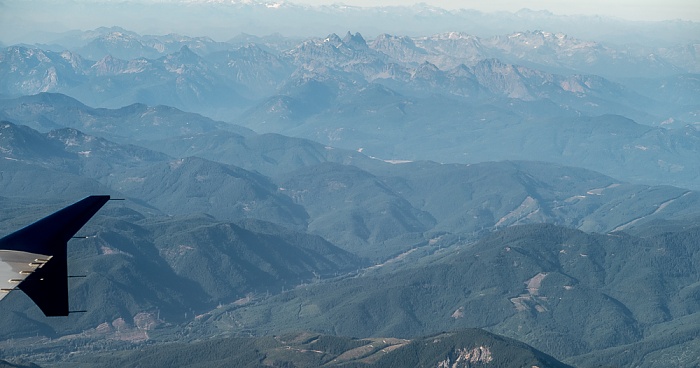
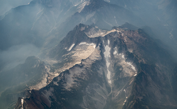
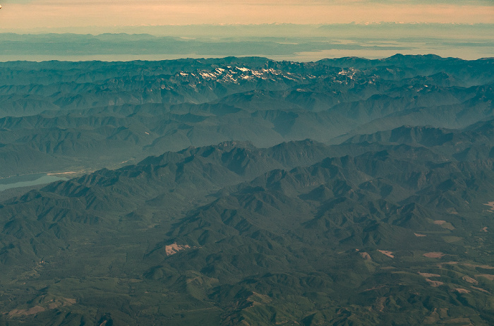
25.08.2017 | 2017 | Flug Salt Lake City - Seattle
Cascade Range (Kaskadenkette) mit dem Mount Baker (oben Bildmitte) und Mount Shuksan (oben rechts)
Flug Salt Lake City - Seattle. Luftbild.
| Flug DAL1873 Salt Lake City (KSLC) - Seattle/Tacoma (KSEA) | Cascade Range (Kaskadenkette) | Mount Baker | Mount Shuksan |
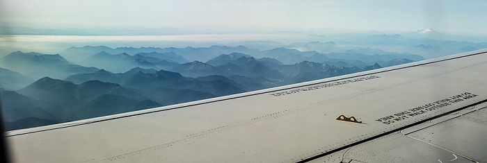
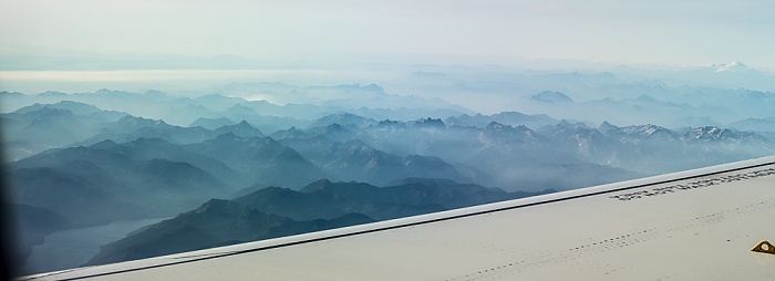
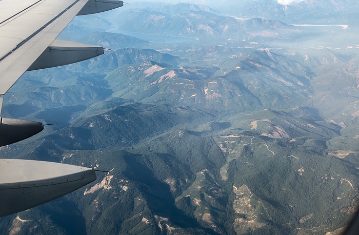
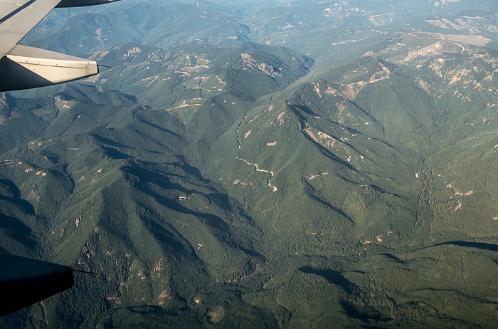
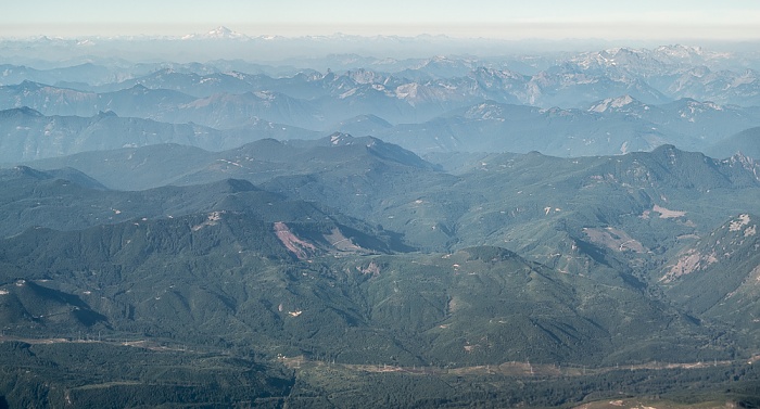
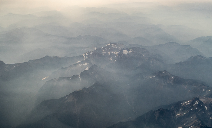
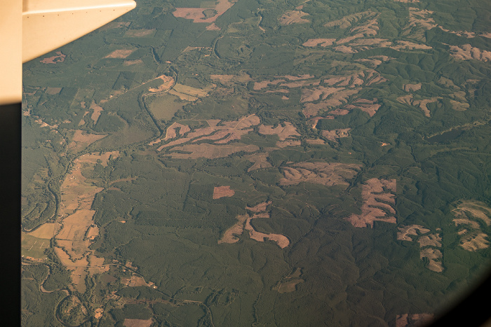
25.08.2017 | 2017 | Flug Salt Lake City - Seattle
Cascade Range (Kaskadenkette)
Flug Salt Lake City - Seattle. Luftbild.
| Flug DAL1873 Salt Lake City (KSLC) - Seattle/Tacoma (KSEA) | Cascade Range (Kaskadenkette) |
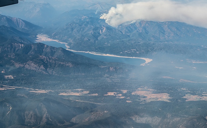
25.08.2017 | 2017 | Flug Salt Lake City - Seattle
Kittitas County: Cle Elum Lake
Flug Salt Lake City - Seattle. Luftbild.
| Flug DAL1873 Salt Lake City (KSLC) - Seattle/Tacoma (KSEA) | Cle Elum Lake | Kittitas County |
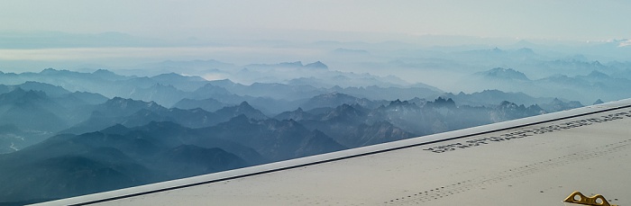
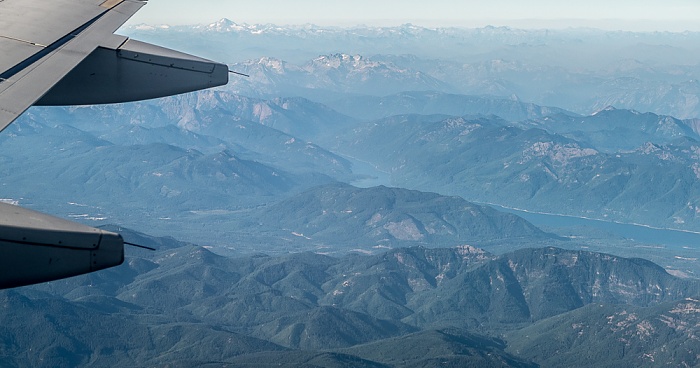
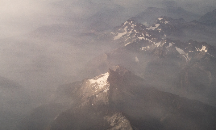
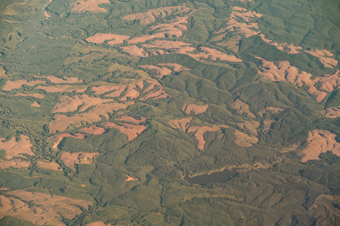
25.08.2017 | 2017 | Flug Salt Lake City - Seattle
Cascade Range (Kaskadenkette)
Flug Salt Lake City - Seattle. Luftbild.
| Flug DAL1873 Salt Lake City (KSLC) - Seattle/Tacoma (KSEA) | Cascade Range (Kaskadenkette) |
25.08.2017 | 2017 | Flug Salt Lake City - Seattle
Kittitas County: Cascade Range (Kaskadenkette)
Oben in der Bildmitte der Kachess Lake, rechts oben der Cle Elum Lake. Flug Salt Lake City - Seattle. Luftbild.
| Flug DAL1873 Salt Lake City (KSLC) - Seattle/Tacoma (KSEA) | Cascade Range (Kaskadenkette) | Cle Elum Lake | Kachess Lake |
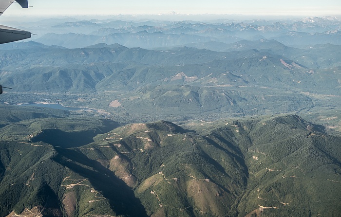
25.08.2017 | 2017 | Flug Salt Lake City - Seattle
Kittitas County: Cascade Range (Kaskadenkette) mit dem Kachess Lake
Links oben der Glacier Peak. Flug Salt Lake City - Seattle. Luftbild.
| Flug DAL1873 Salt Lake City (KSLC) - Seattle/Tacoma (KSEA) | Cascade Range (Kaskadenkette) | Glacier Peak | Kachess Lake | Kittitas County |
25.08.2017 | 2017 | Flug Salt Lake City - Seattle
Kittitas County: Cascade Range (Kaskadenkette) mit dem Keechelus Lake (links) und dem Kachess Lake
Links oben der Glacier Peak. Flug Salt Lake City - Seattle. Luftbild.
| Flug DAL1873 Salt Lake City (KSLC) - Seattle/Tacoma (KSEA) | Cascade Range (Kaskadenkette) | Glacier Peak | Kachess Lake | Keechelus Lake | Kittitas County |
25.08.2017 | 2017 | Flug Salt Lake City - Seattle
Kittitas County: Cascade Range (Kaskadenkette) mit dem Keechelus Lake (links)
Links oben der Glacier Peak. Flug Salt Lake City - Seattle. Luftbild.
| Flug DAL1873 Salt Lake City (KSLC) - Seattle/Tacoma (KSEA) | Cascade Range (Kaskadenkette) | Glacier Peak | Keechelus Lake | Kittitas County |
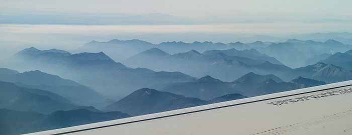
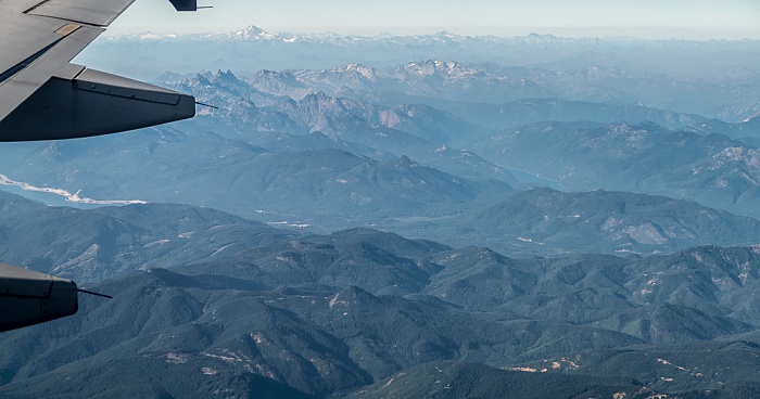
25.08.2017 | 2017 | Flug Salt Lake City - Seattle
Cascade Range (Kaskadenkette)
Flug Salt Lake City - Seattle. Luftbild.
| Flug DAL1873 Salt Lake City (KSLC) - Seattle/Tacoma (KSEA) | Cascade Range (Kaskadenkette) |
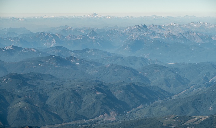
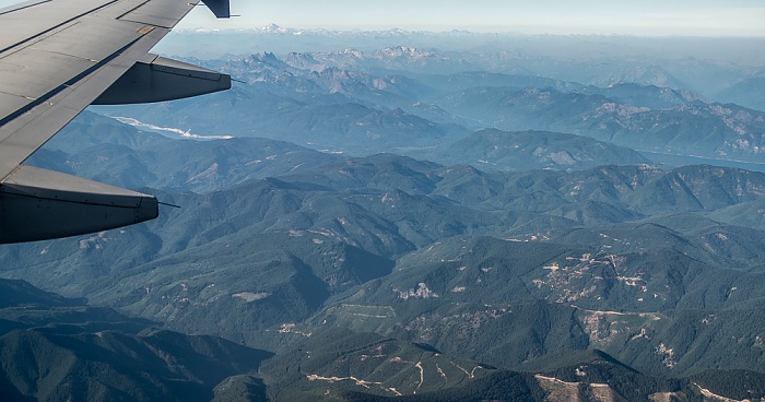
25.08.2017 | 2017 | Flug Salt Lake City - Seattle
Cascade Range (Kaskadenkette)
Oben der Glacier Peak. Flug Salt Lake City - Seattle. Luftbild.
| Flug DAL1873 Salt Lake City (KSLC) - Seattle/Tacoma (KSEA) | Cascade Range (Kaskadenkette) | Glacier Peak |
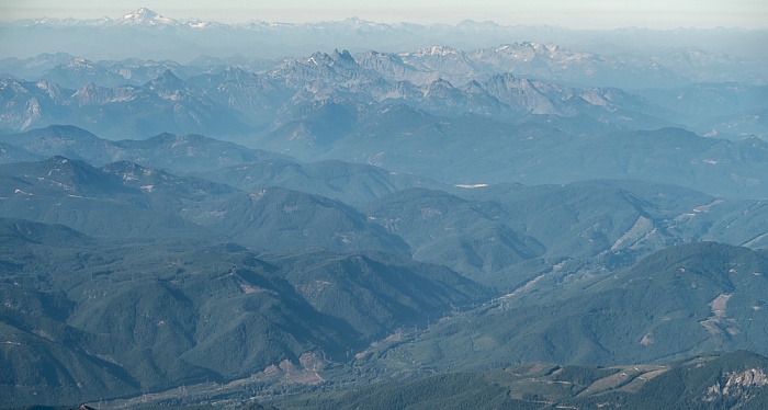
25.08.2017 | 2017 | Flug Salt Lake City - Seattle
Cascade Range (Kaskadenkette)
Links oben der Glacier Peak. Flug Salt Lake City - Seattle. Luftbild.
| Flug DAL1873 Salt Lake City (KSLC) - Seattle/Tacoma (KSEA) | Cascade Range (Kaskadenkette) | Glacier Peak |
25.08.2017 | 2017 | Flug Salt Lake City - Seattle
King County: Cascade Range (Kaskadenkette)
Flug Salt Lake City - Seattle. Luftbild.
| Flug DAL1873 Salt Lake City (KSLC) - Seattle/Tacoma (KSEA) | Cascade Range (Kaskadenkette) | King County |
25.08.2017 | 2017 | Flug Salt Lake City - Seattle
King County: Cascade Range (Kaskadenkette)
Flug Salt Lake City - Seattle. Luftbild.
| Flug DAL1873 Salt Lake City (KSLC) - Seattle/Tacoma (KSEA) | Cascade Range (Kaskadenkette) | King County |
25.08.2017 | 2017 | Flug Salt Lake City - Seattle
King County: Cascade Range (Kaskadenkette)
Flug Salt Lake City - Seattle. Luftbild.
| Flug DAL1873 Salt Lake City (KSLC) - Seattle/Tacoma (KSEA) | Cascade Range (Kaskadenkette) | King County |
25.08.2017 | 2017 | Flug Salt Lake City - Seattle
King County: Cascade Range (Kaskadenkette)
Flug Salt Lake City - Seattle. Luftbild.
| Flug DAL1873 Salt Lake City (KSLC) - Seattle/Tacoma (KSEA) | Cascade Range (Kaskadenkette) | King County |
25.08.2017 | 2017 | Flug Salt Lake City - Seattle
King County: Cascade Range (Kaskadenkette)
Links in der Bildmitte das Howard A Hanson Reservoir. Flug Salt Lake City - Seattle. Luftbild.
| Flug DAL1873 Salt Lake City (KSLC) - Seattle/Tacoma (KSEA) | Cascade Range (Kaskadenkette) | Howard A Hanson Reservoir | King County |
25.08.2017 | 2017 | Flug Salt Lake City - Seattle
King County: Cascade Range (Kaskadenkette)
In der Bildmitte das Howard A Hanson Reservoir. Rechts von der Bildmitte der Lynn Lake. Flug Salt Lake City - Seattle. Luftbild.
| Flug DAL1873 Salt Lake City (KSLC) - Seattle/Tacoma (KSEA) | Cascade Range (Kaskadenkette) | Howard A Hanson Reservoir | King County | Lynn Lake |
25.08.2017 | 2017 | Flug Salt Lake City - Seattle
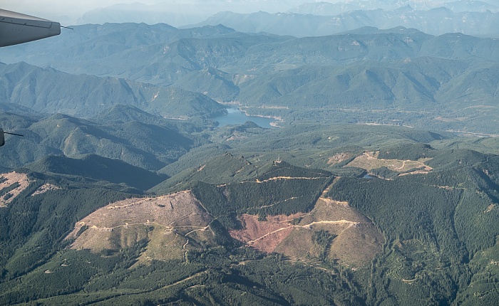
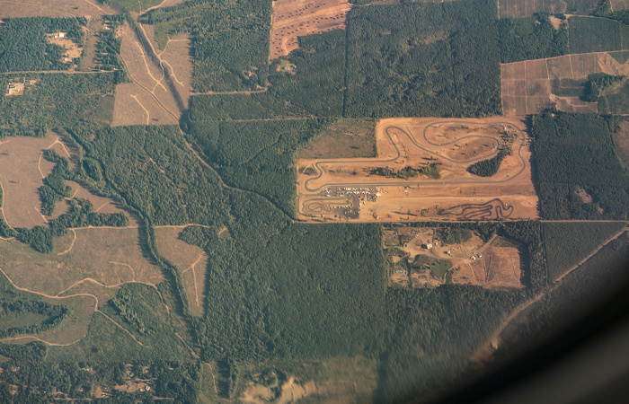
King County: Cascade Range (Kaskadenkette)
Links in der Bildmitte die Corliss Resources. Flug Salt Lake City - Seattle. Luftbild.
| Flug DAL1873 Salt Lake City (KSLC) - Seattle/Tacoma (KSEA) | Cascade Range (Kaskadenkette) | Corliss Resources | King County |
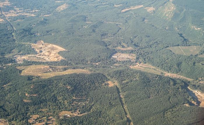
25.08.2017 | 2017 | Flug Salt Lake City - Seattle
King County: Enumclaw
In der Bildmitte die Corliss Resources. Flug Salt Lake City - Seattle. Luftbild.
| Flug DAL1873 Salt Lake City (KSLC) - Seattle/Tacoma (KSEA) | Corliss Resources | Enumclaw | King County |
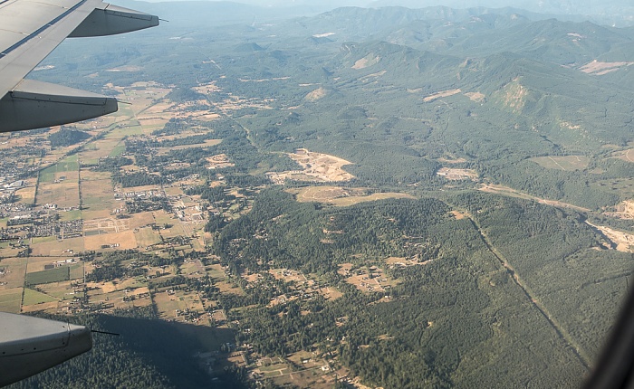
25.08.2017 | 2017 | Flug Salt Lake City - Seattle
King County: Enumclaw
Flug Salt Lake City - Seattle. Luftbild.
| Flug DAL1873 Salt Lake City (KSLC) - Seattle/Tacoma (KSEA) | Enumclaw | King County |
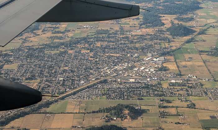
25.08.2017 | 2017 | Flug Salt Lake City - Seattle
Pierce County / King County (v.u.): Buckley, White River, Enumclaw
Flug Salt Lake City - Seattle. Luftbild.
| Flug DAL1873 Salt Lake City (KSLC) - Seattle/Tacoma (KSEA) | Buckley | Enumclaw | King County | Pierce County | White River |
25.08.2017 | 2017 | Flug Salt Lake City - Seattle
Pierce County / King County (v.u.): Buckley, White River, Enumclaw
Flug Salt Lake City - Seattle. Luftbild.
| Flug DAL1873 Salt Lake City (KSLC) - Seattle/Tacoma (KSEA) | Buckley | Enumclaw | King County | Pierce County | White River |
25.08.2017 | 2017 | Flug Salt Lake City - Seattle
Pierce County / King County
Flug Salt Lake City - Seattle. Luftbild.
| Flug DAL1873 Salt Lake City (KSLC) - Seattle/Tacoma (KSEA) | King County | Pierce County |
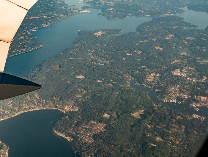
25.08.2017 | 2017 | Flug Salt Lake City - Seattle
Pierce County: Bonney Lake
Links oben der Lake Tapps. Flug Salt Lake City - Seattle. Luftbild.
| Flug DAL1873 Salt Lake City (KSLC) - Seattle/Tacoma (KSEA) | Bonney Lake | Lake Tapps | Pierce County |
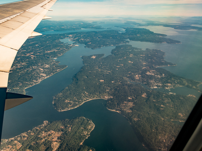
25.08.2017 | 2017 | Flug Salt Lake City - Seattle
Pierce County: Bonney Lake, Lake Tapps
Links oben der Puget Sound. Flug Salt Lake City - Seattle. Luftbild.
| Flug DAL1873 Salt Lake City (KSLC) - Seattle/Tacoma (KSEA) | Bonney Lake | Lake Tapps | Pierce County | Puget Sound |
25.08.2017 | 2017 | Flug Salt Lake City - Seattle
Pierce County: Bonney Lake
Flug Salt Lake City - Seattle. Luftbild.
| Flug DAL1873 Salt Lake City (KSLC) - Seattle/Tacoma (KSEA) | Bonney Lake | Pierce County |
25.08.2017 | 2017 | Flug Salt Lake City - Seattle
Pierce County: Bonney Lake, Washington State Route 410
Links oben der Lake Tapps. Flug Salt Lake City - Seattle. Luftbild.
| Flug DAL1873 Salt Lake City (KSLC) - Seattle/Tacoma (KSEA) | Bonney Lake | Lake Tapps | Pierce County | Washington State Route 410 |
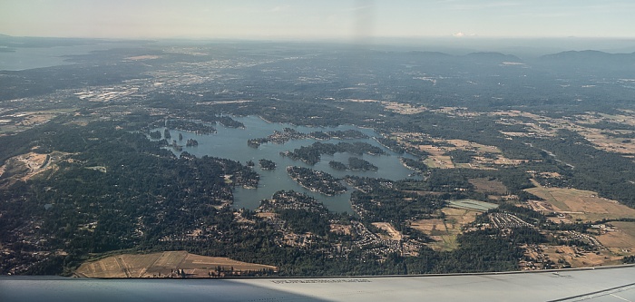
25.08.2017 | 2017 | Flug Salt Lake City - Seattle
Pierce County: Lake Tapps, Bonney Lake
Flug Salt Lake City - Seattle. Luftbild.
| Flug DAL1873 Salt Lake City (KSLC) - Seattle/Tacoma (KSEA) | Bonney Lake | Lake Tapps | Pierce County |
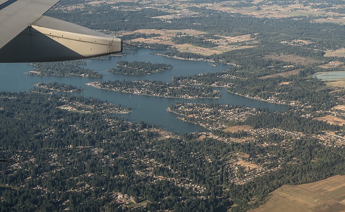
25.08.2017 | 2017 | Flug Salt Lake City - Seattle
Pierce County: Lake Tapps, Bonney Lake
Flug Salt Lake City - Seattle. Luftbild.
| Flug DAL1873 Salt Lake City (KSLC) - Seattle/Tacoma (KSEA) | Bonney Lake | Lake Tapps | Pierce County |
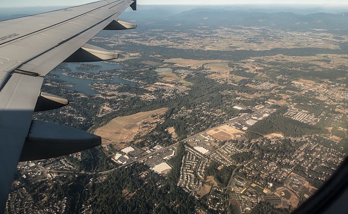
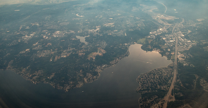
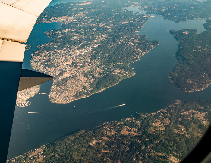
25.08.2017 | 2017 | Flug Salt Lake City - Seattle
Pierce County: Sumner, Washington State Route 167 (Valley Freeway)
Oben der Lake Tapps. Flug Salt Lake City - Seattle. Luftbild.
| Flug DAL1873 Salt Lake City (KSLC) - Seattle/Tacoma (KSEA) | Lake Tapps | Pierce County | Sumner | Washington State Route 167 (Valley Freeway) |
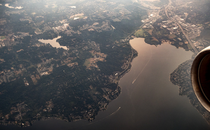
25.08.2017 | 2017 | Flug Salt Lake City - Seattle
Pierce County: Sumner
Oben der Lake Tapps. Flug Salt Lake City - Seattle. Luftbild.
| Flug DAL1873 Salt Lake City (KSLC) - Seattle/Tacoma (KSEA) | Lake Tapps | Pierce County | Sumner |
25.08.2017 | 2017 | Flug Salt Lake City - Seattle
Pierce County: Sumner, Washington State Route 167 (Valley Freeway), Puyallup River
Rechts unten die Washington State Route 410. Flug Salt Lake City - Seattle. Luftbild.
| Flug DAL1873 Salt Lake City (KSLC) - Seattle/Tacoma (KSEA) | Pierce County | Puyallup River | Sumner | Washington State Route 167 (Valley Freeway) | Washington State Route 410 |
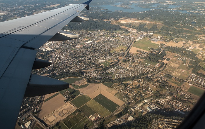
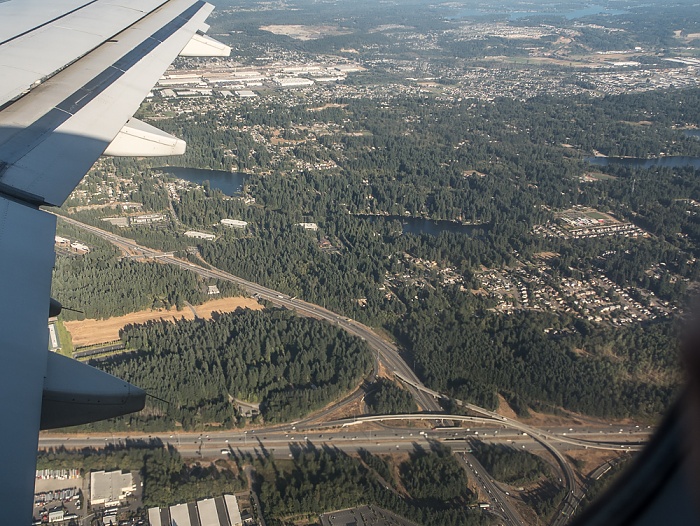
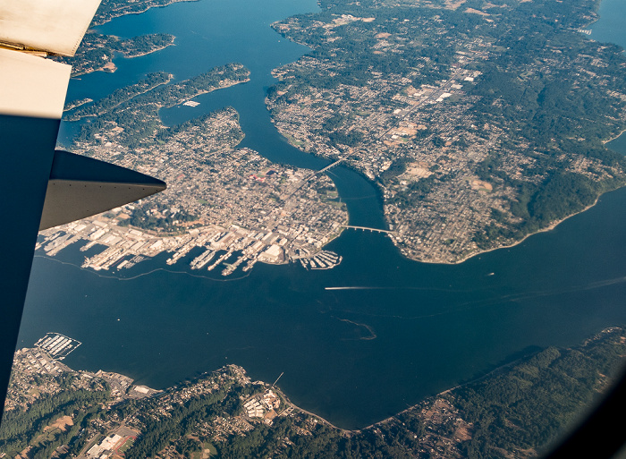
25.08.2017 | 2017 | Flug Salt Lake City - Seattle
Pierce County (unten) / King County
Unten Edgewood, darüber Lakeland South, rechts davon Sumner und darüber Pacific. Flug Salt Lake City - Seattle. Luftbild.
| Flug DAL1873 Salt Lake City (KSLC) - Seattle/Tacoma (KSEA) | Edgewood | King County | Lakeland South | Pacific | Pierce County | Sumner |
25.08.2017 | 2017 | Flug Salt Lake City - Seattle
Pierce County: Sumner, Washington State Route 167 (Valley Freeway), Puyallup River
Linksn Edgewood. Flug Salt Lake City - Seattle. Luftbild.
| Flug DAL1873 Salt Lake City (KSLC) - Seattle/Tacoma (KSEA) | Edgewood | Pierce County | Puyallup River | Sumner | Washington State Route 167 (Valley Freeway) |
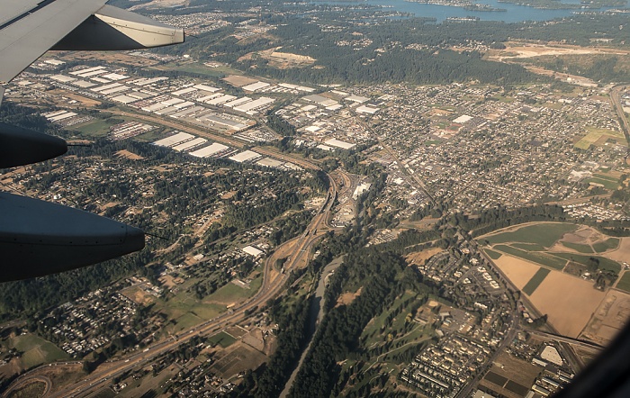
25.08.2017 | 2017 | Flug Salt Lake City - Seattle
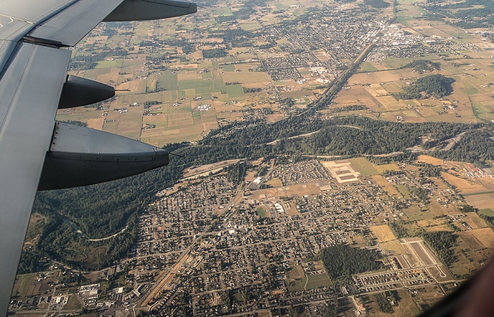
King County: Auburn
In der Bildmitte die Boeing Auburn Site. Flug Salt Lake City - Seattle. Luftbild.
| Flug DAL1873 Salt Lake City (KSLC) - Seattle/Tacoma (KSEA) | Auburn | Boeing Auburn Site | King County |
25.08.2017 | 2017 | Flug Salt Lake City - Seattle
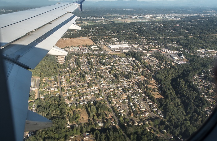
Pierce County: Edgewood
Oben Sumner. Flug Salt Lake City - Seattle. Luftbild.
| Flug DAL1873 Salt Lake City (KSLC) - Seattle/Tacoma (KSEA) | Edgewood | Pierce County | Sumner |
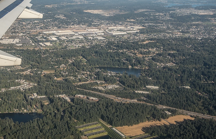
25.08.2017 | 2017 | Flug Salt Lake City - Seattle
Pierce County: Edgewood
Oben Sumner. Unten der Surprise Lake. Flug Salt Lake City - Seattle. Luftbild.
| Flug DAL1873 Salt Lake City (KSLC) - Seattle/Tacoma (KSEA) | Edgewood | Pierce County | Sumner | Surprise Lake |
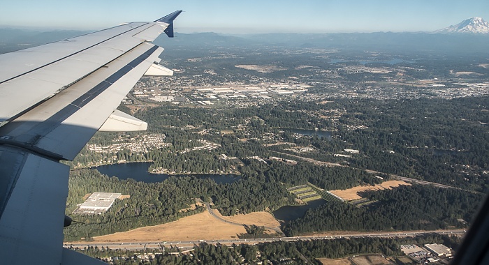
25.08.2017 | 2017 | Flug Salt Lake City - Seattle
Pierce County: Edgewood
Oben Sumner. Rechts unten der Surprise Lake. Flug Salt Lake City - Seattle. Luftbild.
| Flug DAL1873 Salt Lake City (KSLC) - Seattle/Tacoma (KSEA) | Edgewood | Pierce County | Sumner | Surprise Lake |
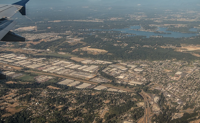
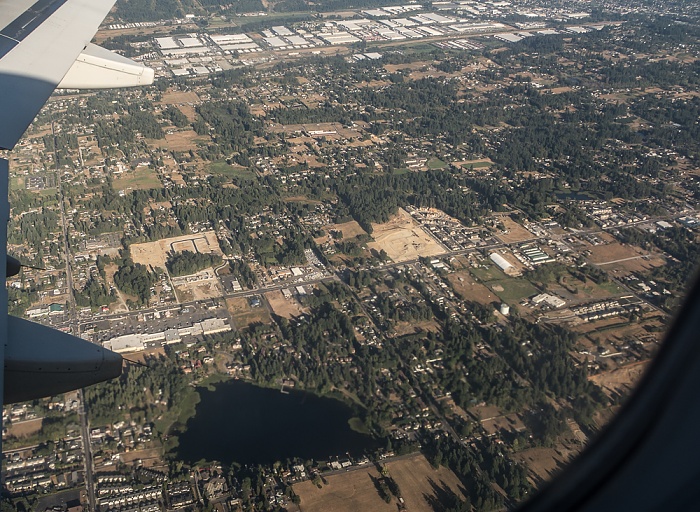
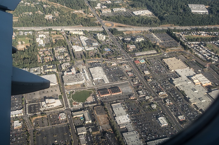
25.08.2017 | 2017 | Flug Salt Lake City - Seattle
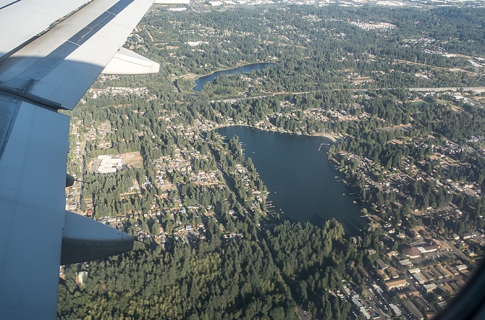
King County: Lakeland South mit dem Enchanted Parkway South
Flug Salt Lake City - Seattle. Luftbild.
| Flug DAL1873 Salt Lake City (KSLC) - Seattle/Tacoma (KSEA) | Enchanted Parkway South | King County | Lakeland South |
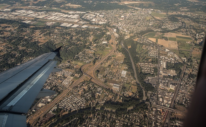
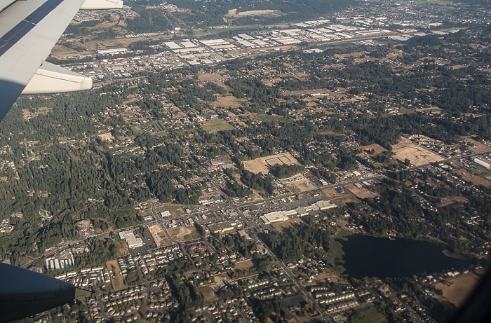
25.08.2017 | 2017 | Flug Salt Lake City - Seattle
King County: Lakeland South mit dem Five Mile Lake (links) und dem Trout Lake
Rechts unten der Enchanted Parkway South. Flug Salt Lake City - Seattle. Luftbild.
| Flug DAL1873 Salt Lake City (KSLC) - Seattle/Tacoma (KSEA) | Enchanted Parkway South | Five Mile Lake | King County | Lakeland South | Trout Lake |
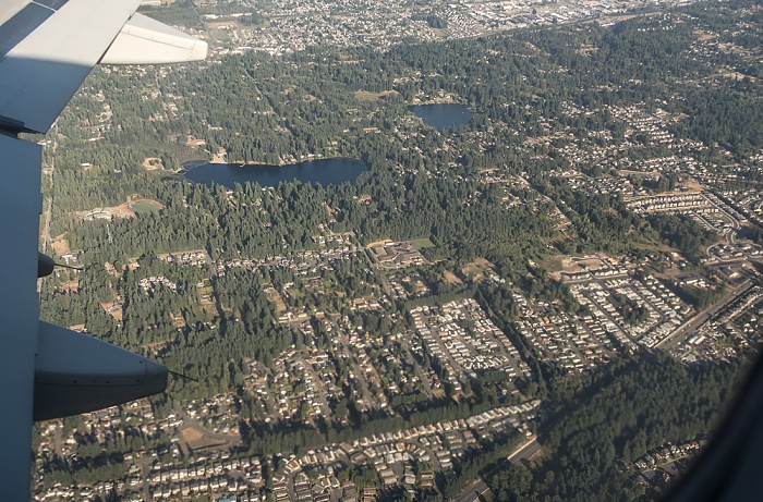
25.08.2017 | 2017 | Flug Salt Lake City - Seattle
King County: Lakeland South mit v.l. dem Lake Geneva, dem Lake Killarney und dem Five Mile Lake
Unten die Interstate I-5, darüber die Washington State Route 18. Oben Auburn. Flug Salt Lake City - Seattle. Luftbild.
| Flug DAL1873 Salt Lake City (KSLC) - Seattle/Tacoma (KSEA) | Auburn | Five Mile Lake | Interstate I-5 | King County | Lake Geneva | Lake Killarney | Lakeland South | Washington State Route 18 |
25.08.2017 | 2017 | Flug Salt Lake City - Seattle
King County (v.l.): Federal Way mit dem North Lake, Washington State Route 18, Lakeland South mit dem Lake Geneva
Oben Auburn. Flug Salt Lake City - Seattle. Luftbild.
| Flug DAL1873 Salt Lake City (KSLC) - Seattle/Tacoma (KSEA) | Auburn | Federal Way | King County | Lake Geneva | Lakeland South | North Lake | Washington State Route 18 |
25.08.2017 | 2017 | Flug Salt Lake City - Seattle
King County (v.l.): Federal Way mit dem North Lake, Washington State Route 18, Lakeland South mit dem Lake Geneva
Unten die Interstate I-5. Links unten die Weyerhaeuser Wood Products Laboratory. Oben Auburn. Rechts oben der Mount Rainier. Flug Salt Lake City - Seattle. Luftbild.
| Flug DAL1873 Salt Lake City (KSLC) - Seattle/Tacoma (KSEA) | Auburn | Federal Way | Interstate I-5 | King County | Lake Geneva | Lakeland South | Mount Rainier | North Lake | Washington State Route 18 | Weyerhaeuser Wood Products Laboratory |
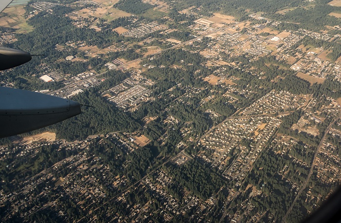
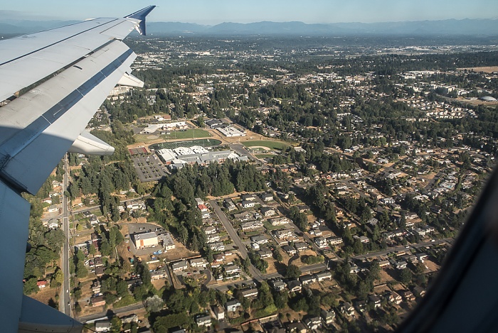
25.08.2017 | 2017 | Flug Salt Lake City - Seattle
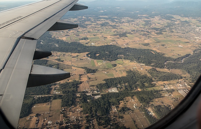
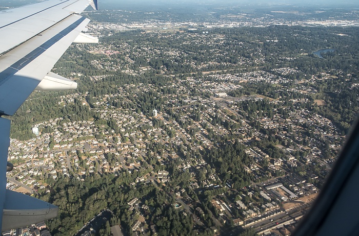
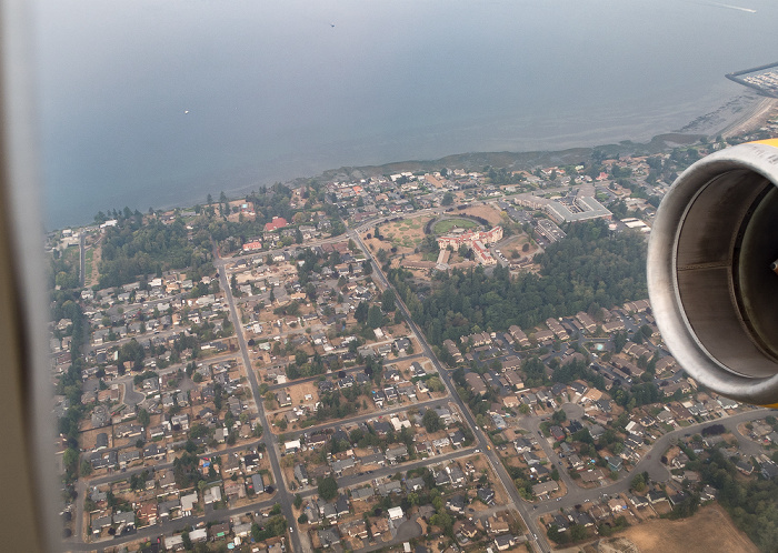
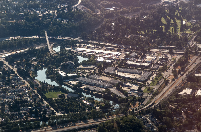
King County: Federal Way
Oben die Interstate I-5. Rechts die South 320th Street. Links unterhalb der Bildmitte der Town Square Park und das Center Plaza. Flug Salt Lake City - Seattle. Luftbild.
| Flug DAL1873 Salt Lake City (KSLC) - Seattle/Tacoma (KSEA) | Federal Way | Interstate I-5 | King County |
25.08.2017 | 2017 | Flug Salt Lake City - Seattle
King County: Federal Way mit dem Steel Lake
Oben die Interstate I-5 und der Lake Dolloff. Flug Salt Lake City - Seattle. Luftbild.
| Flug DAL1873 Salt Lake City (KSLC) - Seattle/Tacoma (KSEA) | Federal Way | Interstate I-5 | King County | Lake Dolloff | Steel Lake |
25.08.2017 | 2017 | Flug Salt Lake City - Seattle
King County: Federal Way / Lakeland North (oben)
Flug Salt Lake City - Seattle. Luftbild.
| Flug DAL1873 Salt Lake City (KSLC) - Seattle/Tacoma (KSEA) | Federal Way | King County | Lakeland North |
25.08.2017 | 2017 | Flug Salt Lake City - Seattle
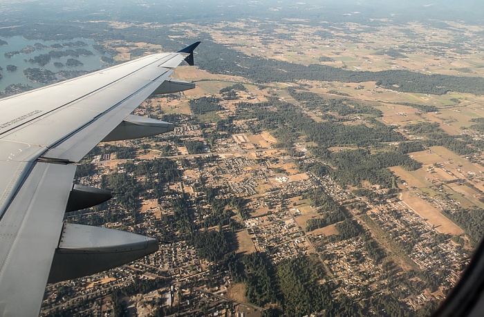
King County: Des Moines
Rechts der South Fork McSorley Creek. Flug Salt Lake City - Seattle. Luftbild.
| Flug DAL1873 Salt Lake City (KSLC) - Seattle/Tacoma (KSEA) | Des Moines | King County | South Fork McSorley Creek |
25.08.2017 | 2017 | Flug Salt Lake City - Seattle
King County: Des Moines
Flug Salt Lake City - Seattle. Luftbild.
| Flug DAL1873 Salt Lake City (KSLC) - Seattle/Tacoma (KSEA) | Des Moines | King County |
16.09.2017 | 2017 | Flug Seattle - Keflavik
King County: Des Moines
Oben der Pudget Sound (East Passage). Rechts oben das Masonic Home of Washington. Flug Seattle - Keflavik. Luftbild.
| Flug ICE684 Seattle/Tacoma (KSEA) - Keflavík (KEF/BIKF) | Des Moines | East Passage | King County | Masonic Home of Washington |
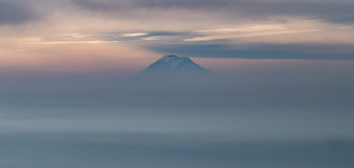
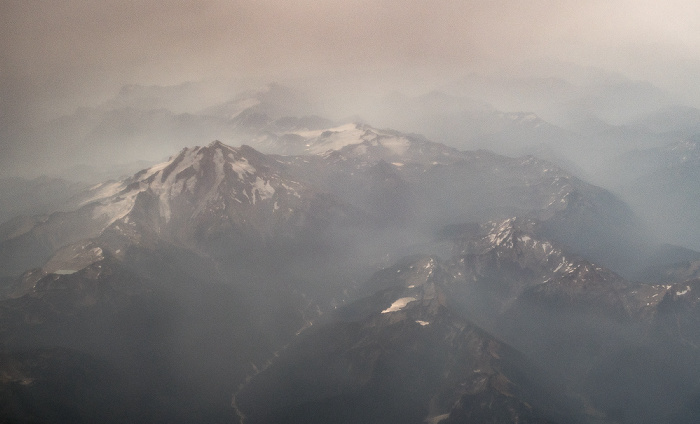
16.09.2017 | 2017 | Flug Seattle - Keflavik
Cascade Range (Kaskadenkette): Mount Rainier
Flug Seattle - Keflavik. Luftbild.
| Flug ICE684 Seattle/Tacoma (KSEA) - Keflavík (KEF/BIKF) | Cascade Range (Kaskadenkette) | Mount Rainier |
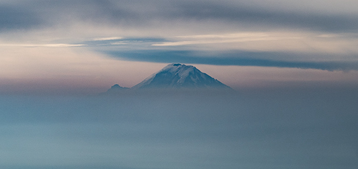
16.09.2017 | 2017 | Flug Seattle - Keflavik
Cascade Range (Kaskadenkette): Mount Rainier
Flug Seattle - Keflavik. Luftbild.
| Flug ICE684 Seattle/Tacoma (KSEA) - Keflavík (KEF/BIKF) | Cascade Range (Kaskadenkette) | Mount Rainier |
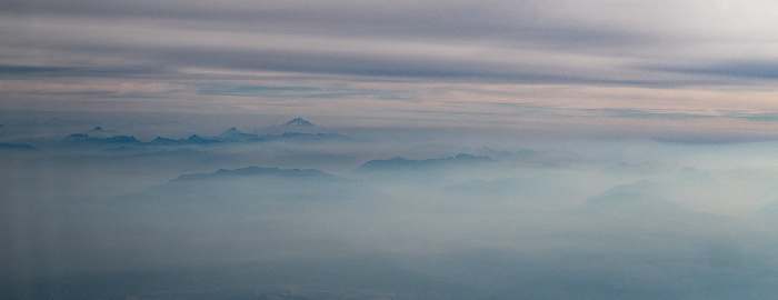
16.09.2017 | 2017 | Flug Seattle - Keflavik
Cascade Range (Kaskadenkette)
Flug Seattle - Keflavik. Luftbild.
| Flug ICE684 Seattle/Tacoma (KSEA) - Keflavík (KEF/BIKF) | Cascade Range (Kaskadenkette) |
16.09.2017 | 2017 | Flug Seattle - Keflavik
King County: Lake Sammamish, Sammamish, Interstate I-90 (American Veterans Memorial Highway)
Rechts oben Issaquah. In der Bildmitte der Pine Lake. Flug Seattle - Keflavik. Luftbild.
| Flug ICE684 Seattle/Tacoma (KSEA) - Keflavík (KEF/BIKF) | Interstate I-90 (American Veterans Memorial Highway) | Issaquah | King County | Lake Sammamish | Pine Lake | Sammamish |
16.09.2017 | 2017 | Flug Seattle - Keflavik
King County: Lake Sammamish, Sammamish,
Rechts oben Issaquah und die Interstate I-90 (American Veterans Memorial Highway).Links oberhalb der Bildmitte der Pine Lake. Links oben der Beaver Lake. Flug Seattle - Keflavik. Luftbild.
| Flug ICE684 Seattle/Tacoma (KSEA) - Keflavík (KEF/BIKF) | Beaver Lake | Interstate I-90 (American Veterans Memorial Highway) | Issaquah | King County | Lake Sammamish | Pine Lake | Sammamish |
16.09.2017 | 2017 | Flug Seattle - Keflavik
Cascade Range (Kaskadenkette)
Flug Seattle - Keflavik. Luftbild.
| Flug ICE684 Seattle/Tacoma (KSEA) - Keflavík (KEF/BIKF) | Cascade Range (Kaskadenkette) |
16.09.2017 | 2017 | Flug Seattle - Keflavik
Cascade Range (Kaskadenkette)
Flug Seattle - Keflavik. Luftbild.
| Flug ICE684 Seattle/Tacoma (KSEA) - Keflavík (KEF/BIKF) | Cascade Range (Kaskadenkette) |
16.09.2017 | 2017 | Flug Seattle - Keflavik
Cascade Range (Kaskadenkette)
Flug Seattle - Keflavik. Luftbild.
| Flug ICE684 Seattle/Tacoma (KSEA) - Keflavík (KEF/BIKF) | Cascade Range (Kaskadenkette) |
16.09.2017 | 2017 | Flug Seattle - Keflavik
Cascade Range (Kaskadenkette)
Flug Seattle - Keflavik. Luftbild.
| Flug ICE684 Seattle/Tacoma (KSEA) - Keflavík (KEF/BIKF) | Cascade Range (Kaskadenkette) |
16.09.2017 | 2017 | Flug Seattle - Keflavik
Cascade Range (Kaskadenkette)
Flug Seattle - Keflavik. Luftbild.
16.09.2017 | 2017 | Flug Seattle - Keflavik
Skykomish River, Cascade Range (Kaskadenkette)
Flug Seattle - Keflavik. Luftbild.
| Flug ICE684 Seattle/Tacoma (KSEA) - Keflavík (KEF/BIKF) | Cascade Range (Kaskadenkette) | Skykomish River |
16.09.2017 | 2017 | Flug Seattle - Keflavik
Skykomish River, Cascade Range (Kaskadenkette)
Flug Seattle - Keflavik. Luftbild.
16.09.2017 | 2017 | Flug Seattle - Keflavik
Skykomish River, Cascade Range (Kaskadenkette)
Flug Seattle - Keflavik. Luftbild.
| Flug ICE684 Seattle/Tacoma (KSEA) - Keflavík (KEF/BIKF) | Cascade Range (Kaskadenkette) | Skykomish River |
16.09.2017 | 2017 | Flug Seattle - Keflavik
Spada Lake (links), Cascade Range (Kaskadenkette)
Rechts der Wallace Falls State Park mit v.u. dem Shaw Lake, dem Jay Lake und dem Wallace Lake. Flug Seattle - Keflavik. Luftbild.
| Flug ICE684 Seattle/Tacoma (KSEA) - Keflavík (KEF/BIKF) | Cascade Range (Kaskadenkette) | Jay Lake | Shaw Lake | Spada Lake | Wallace Falls State Park | Wallace Lake |
16.09.2017 | 2017 | Flug Seattle - Keflavik
Cascade Range (Kaskadenkette) mit der Henry M. Jackson Wilderness
Flug Seattle - Keflavik. Luftbild.
| Flug ICE684 Seattle/Tacoma (KSEA) - Keflavík (KEF/BIKF) | Cascade Range (Kaskadenkette) | Henry M. Jackson Wilderness |
16.09.2017 | 2017 | Flug Seattle - Keflavik
Cascade Range (Kaskadenkette) mit der Henry M. Jackson Wilderness
Flug Seattle - Keflavik. Luftbild.
16.09.2017 | 2017 | Flug Seattle - Keflavik
Cascade Range (Kaskadenkette) mit der Henry M. Jackson Wilderness
Flug Seattle - Keflavik. Luftbild.
| Flug ICE684 Seattle/Tacoma (KSEA) - Keflavík (KEF/BIKF) | Cascade Range (Kaskadenkette) | Henry M. Jackson Wilderness |
16.09.2017 | 2017 | Flug Seattle - Keflavik
Cascade Range (Kaskadenkette) mit der Glacier Peak Wilderness
Flug Seattle - Keflavik. Luftbild.
16.09.2017 | 2017 | Flug Seattle - Keflavik
Cascade Range (Kaskadenkette) mit der Glacier Peak Wilderness
Flug Seattle - Keflavik. Luftbild.
16.09.2017 | 2017 | Flug Seattle - Keflavik
Cascade Range (Kaskadenkette)
Flug Seattle - Keflavik. Luftbild.
| Flug ICE684 Seattle/Tacoma (KSEA) - Keflavík (KEF/BIKF) | Cascade Range (Kaskadenkette) |
27.08.2017 | 2017 | Flug Seattle - Honolulu
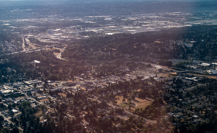
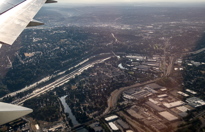
King County: Tukwila, Interstate I-5 (links oben)
Flug Seattle - Honolulu. Luftbild.
| Flug DAL1195 Seattle/Tacoma (KSEA) - Daniel K Inouye Intl (PHNL) | Interstate I-5 | King County | Tukwila |
27.08.2017 | 2017 | Flug Seattle - Honolulu
King County: Tukwila, Interstate I-5 (links oben)
Flug Seattle - Honolulu. Luftbild.
| Flug DAL1195 Seattle/Tacoma (KSEA) - Daniel K Inouye Intl (PHNL) | Interstate I-5 | King County | Tukwila |
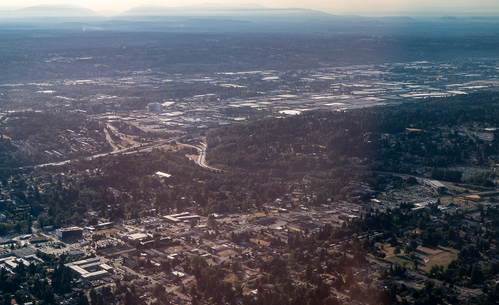
27.08.2017 | 2017 | Flug Seattle - Honolulu
King County: Tukwila, Interstate I-5 (Bildmitte), Washington State Route 599 (links unten)
Flug Seattle - Honolulu. Luftbild.
| Flug DAL1195 Seattle/Tacoma (KSEA) - Daniel K Inouye Intl (PHNL) | Interstate I-5 | King County | Tukwila | Washington State Route 599 |
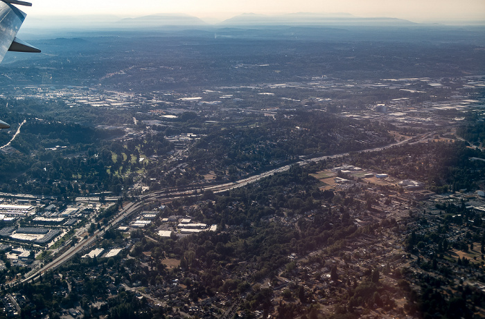
27.08.2017 | 2017 | Flug Seattle - Honolulu
King County: Tukwila mit dem Duwamish River und dem Tukwila Commerce Park, Interstate I-5 (oben), Washington State Route 599 (unten)
Flug Seattle - Honolulu. Luftbild.
| Flug DAL1195 Seattle/Tacoma (KSEA) - Daniel K Inouye Intl (PHNL) | Duwamish River | Interstate I-5 | King County | Tukwila | Tukwila Commerce Park | Washington State Route 599 |
27.08.2017 | 2017 | Flug Seattle - Honolulu
King County: Tukwila mit dem Duwamish River, Interstate I-5 (oben), Washington State Route 599 (unten)
Rechts von der Bildmitte der Tukwila Commerce Park. Flug Seattle - Honolulu. Luftbild.
| Flug DAL1195 Seattle/Tacoma (KSEA) - Daniel K Inouye Intl (PHNL) | Duwamish River | Interstate I-5 | King County | Tukwila | Tukwila Commerce Park | Washington State Route 599 |
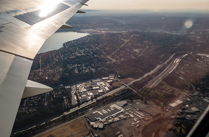
27.08.2017 | 2017 | Flug Seattle - Honolulu
King County: Tukwila, Interstate I-5
Links oben der Lake Washington. Flug Seattle - Honolulu. Luftbild.
| Flug DAL1195 Seattle/Tacoma (KSEA) - Daniel K Inouye Intl (PHNL) | Interstate I-5 | King County | Lake Washington | Tukwila |
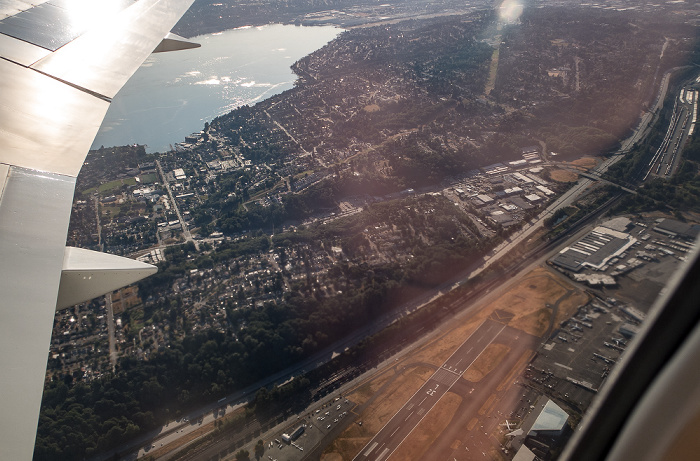
27.08.2017 | 2017 | Flug Seattle - Honolulu
King County: Tukwila, Interstate I-5
Links oben der Lake Washington. Unten das Boeing Field. Flug Seattle - Honolulu. Luftbild.
| Flug DAL1195 Seattle/Tacoma (KSEA) - Daniel K Inouye Intl (PHNL) | Boeing Field | Interstate I-5 | King County | Lake Washington | Tukwila |
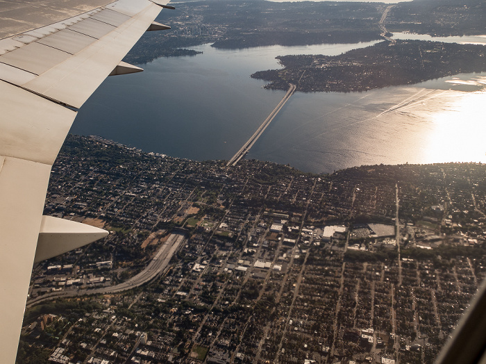
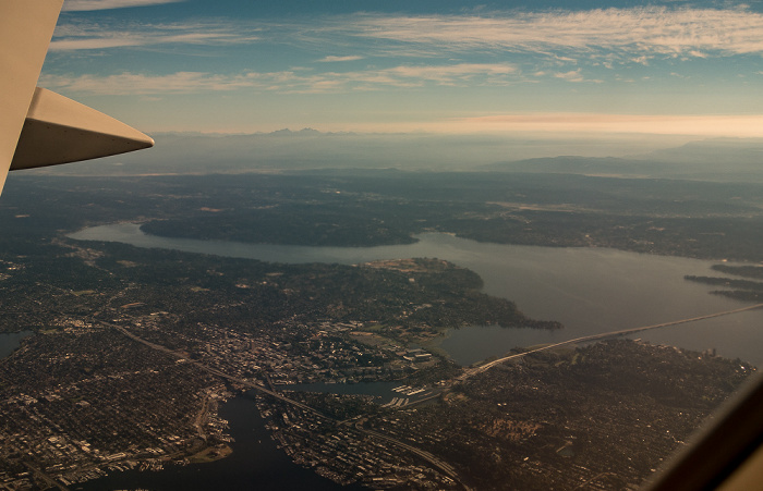
27.08.2017 | 2017 | Flug Seattle - Honolulu
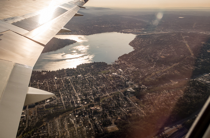
King County: Seattle, Lake Washington
Links oben Mercer Island. Flug Seattle - Honolulu. Luftbild.
| Flug DAL1195 Seattle/Tacoma (KSEA) - Daniel K Inouye Intl (PHNL) | King County | Lake Washington | Mercer Island | Seattle |
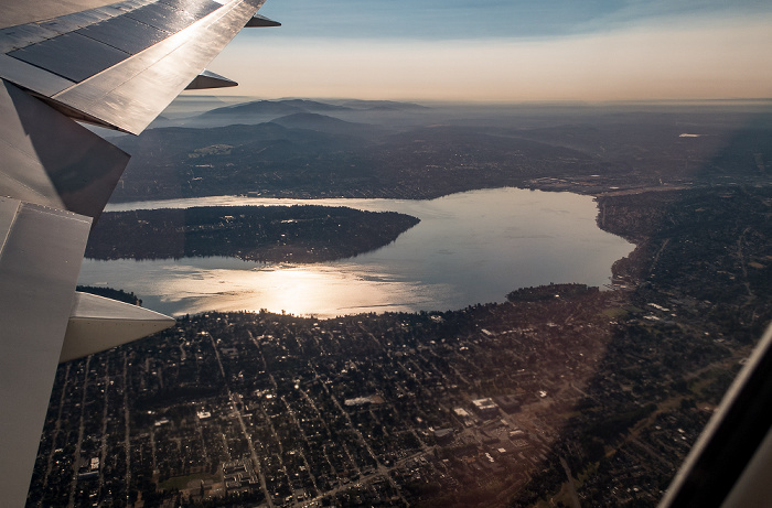
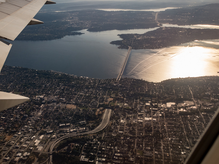
27.08.2017 | 2017 | Flug Seattle - Honolulu
King County: Seattle, Lake Washington mit Mercer Island
Flug Seattle - Honolulu. Luftbild.
| Flug DAL1195 Seattle/Tacoma (KSEA) - Daniel K Inouye Intl (PHNL) | King County | Lake Washington | Mercer Island | Seattle |
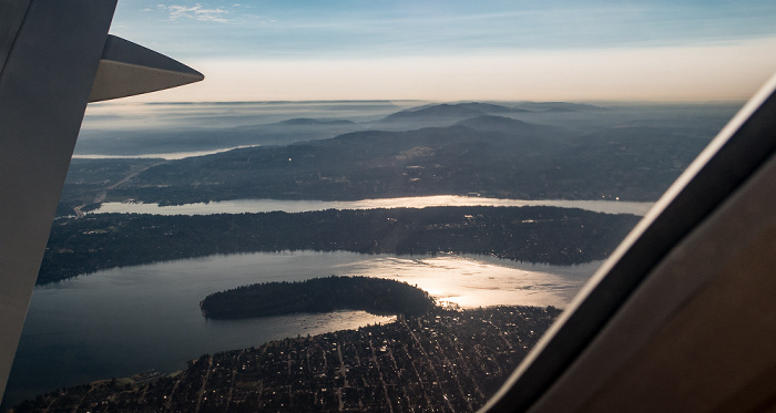
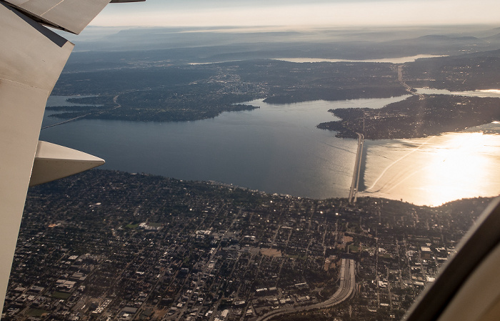
27.08.2017 | 2017 | Flug Seattle - Honolulu
King County: Seattle, Lake Washington mit der Andrews Bay, dem Seward Park und Mercer Island
Oben Bellevue. Flug Seattle - Honolulu. Luftbild.
| Flug DAL1195 Seattle/Tacoma (KSEA) - Daniel K Inouye Intl (PHNL) | Andrews Bay | Bellevue | King County | Lake Washington | Mercer Island | Seattle | Seward Park |
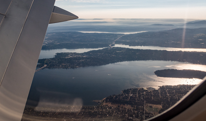
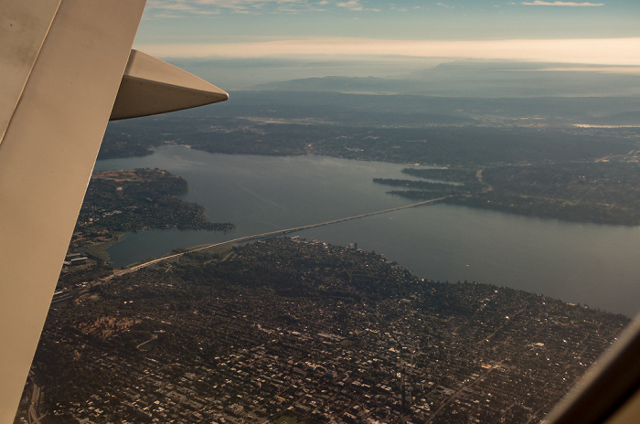
27.08.2017 | 2017 | Flug Seattle - Honolulu
King County: Seattle, Lake Washington mit Mercer Island
Rechts die Andrews Bay und der Seward Park. Oben Bellevue. Flug Seattle - Honolulu. Luftbild.
| Flug DAL1195 Seattle/Tacoma (KSEA) - Daniel K Inouye Intl (PHNL) | Andrews Bay | Bellevue | King County | Lake Washington | Mercer Island | Seattle | Seward Park |
27.08.2017 | 2017 | Flug Seattle - Honolulu
King County: Seattle, Lake Washington mit Mercer Island
In der Bildmitte die Interstate I-90 (American Veterans Memorial Highway) mit dem Mount Baker Ridge Tunnel und der Homer M. Hadley Memorial Bridge. Flug Seattle - Honolulu. Luftbild.
| Flug DAL1195 Seattle/Tacoma (KSEA) - Daniel K Inouye Intl (PHNL) | Homer M. Hadley Memorial Bridge | Interstate I-90 (American Veterans Memorial Highway) | King County | Lake Washington | Mercer Island | Mount Baker Ridge Tunnel | Seattle |
27.08.2017 | 2017 | Flug Seattle - Honolulu
King County: Seattle, Lake Washington mit Mercer Island
In der Bildmitte die Interstate I-90 (American Veterans Memorial Highway) mit dem Mount Baker Ridge Tunnel und der Homer M. Hadley Memorial Bridge. Links oberhalb der Bildmitte die Meydenbauer Bay. Oben der Lake Sammamish. Flug Seattle - Honolulu. Luftbild.
| Flug DAL1195 Seattle/Tacoma (KSEA) - Daniel K Inouye Intl (PHNL) | Homer M. Hadley Memorial Bridge | Interstate I-90 (American Veterans Memorial Highway) | King County | Lake Sammamish | Lake Washington | Mercer Island | Meydenbauer Bay | Mount Baker Ridge Tunnel | Seattle |
27.08.2017 | 2017 | Flug Seattle - Honolulu
King County: Seattle, Lake Washington mit Mercer Island
Rechts von der Bildmitte die Interstate I-90 (American Veterans Memorial Highway) mit dem Mount Baker Ridge Tunnel und der Homer M. Hadley Memorial Bridge. Oberhalb der Bildmitte die Meydenbauer Bay, darüber Bellevue. Oben der Lake Sammamish. Links die Washington State Route 520 mit der Evergreen Point Floating Bridge. Flug Seattle - Honolulu. Luftbild.
| Flug DAL1195 Seattle/Tacoma (KSEA) - Daniel K Inouye Intl (PHNL) | Bellevue | Evergreen Point Floating Bridge | Homer M. Hadley Memorial Bridge | Interstate I-90 (American Veterans Memorial Highway) | King County | Lake Sammamish | Lake Washington | Mercer Island | Meydenbauer Bay | Mount Baker Ridge Tunnel | Seattle | Washington State Route 520 |
27.08.2017 | 2017 | Flug Seattle - Honolulu
King County: Seattle, Lake Washington mit der Washington State Route 520 und der Evergreen Point Floating Bridge
Flug Seattle - Honolulu. Luftbild.
| Flug DAL1195 Seattle/Tacoma (KSEA) - Daniel K Inouye Intl (PHNL) |
27.08.2017 | 2017 | Flug Seattle - Honolulu
King County: Seattle, Lake Washington
Rechts die Washington State Route 520 mit der Evergreen Point Floating Bridge. Links die Interstate I-5. Unten der Lake Washington Ship Canal mit v.l. dem Lake Union, der Ship Canal Bridge, der University Bridge, der Portage Bay und dem Montlake Cut. Flug Seattle - Honolulu. Luftbild.
| Flug DAL1195 Seattle/Tacoma (KSEA) - Daniel K Inouye Intl (PHNL) | Evergreen Point Floating Bridge | Interstate I-5 | King County | Lake Union | Lake Washington | Lake Washington Ship Canal | Montlake Cut | Portage Bay | Seattle | Ship Canal Bridge | University Bridge | Washington State Route 520 |
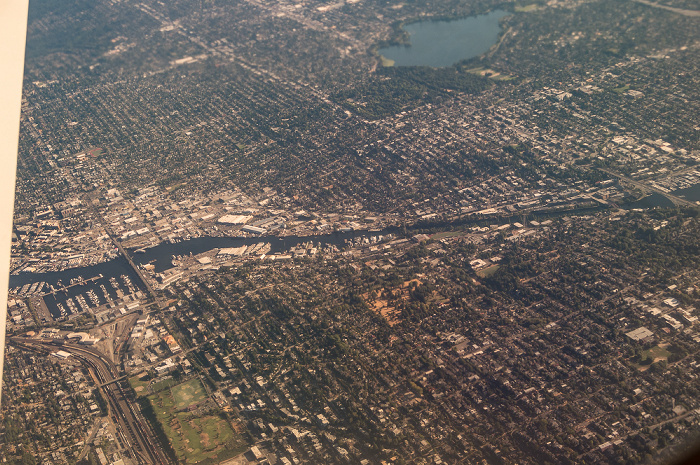
27.08.2017 | 2017 | Flug Seattle - Honolulu
King County: Seattle mit dem Lake Washington Ship Canal
Links unten das Port of Seattle Fishermen's Terminal, Balmer Yard und Interbay Athletic Complex. Rechts oben der Woodland Park und der Green Lake. Flug Seattle - Honolulu. Luftbild.
| Flug DAL1195 Seattle/Tacoma (KSEA) - Daniel K Inouye Intl (PHNL) | Balmer Yard | Green Lake | Interbay Athletic Complex | King County | Lake Washington Ship Canal | Port of Seattle Fishermen's Terminal | Seattle | Woodland Park |
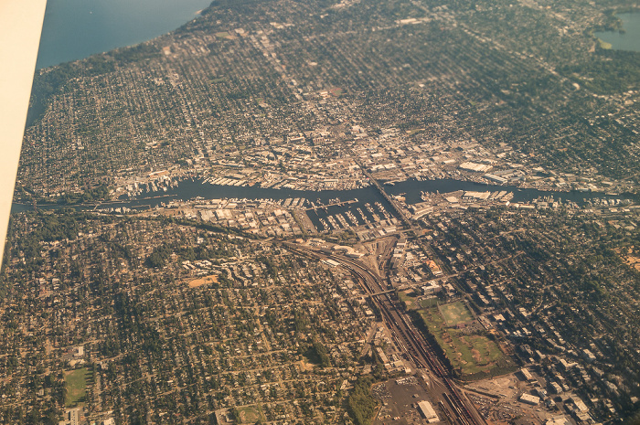
27.08.2017 | 2017 | Flug Seattle - Honolulu
King County: Seattle mit dem Lake Washington Ship Canal, dem Port of Seattle Fishermen's Terminal, Balmer Yard und dem Interbay Athletic Complex
Links oben der Puget Sound. Flug Seattle - Honolulu. Luftbild.
| Flug DAL1195 Seattle/Tacoma (KSEA) - Daniel K Inouye Intl (PHNL) | Balmer Yard | Interbay Athletic Complex | King County | Lake Washington Ship Canal | Port of Seattle Fishermen's Terminal | Puget Sound | Seattle |
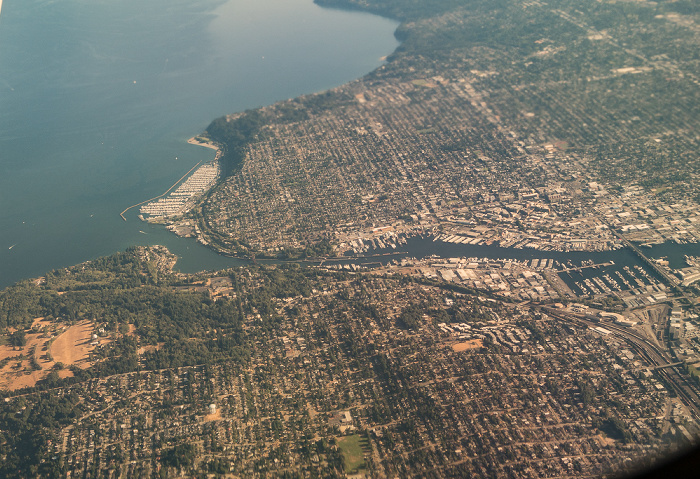
27.08.2017 | 2017 | Flug Seattle - Honolulu
King County: Puget Sound, Seattle mit dem Lake Washington Ship Canal
Links die Shilshole Bay und die Shilshole Bay Marina. Links unten der Discovery Park. Rechts unten das Port of Seattle Fishermen's Terminal und Balmer Yard. Flug Seattle - Honolulu. Luftbild.
| Flug DAL1195 Seattle/Tacoma (KSEA) - Daniel K Inouye Intl (PHNL) | Balmer Yard | Discovery Park | King County | Lake Washington Ship Canal | Port of Seattle Fishermen's Terminal | Puget Sound | Seattle | Shilshole Bay | Shilshole Bay Marina |
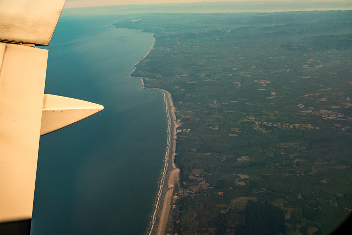
27.08.2017 | 2017 | Flug Seattle - Honolulu
Kitsap County / King County: Puget Sound
Rechts die Shilshole Bay, die Shilshole Bay Marina und der Discovery Park. Links die Bainbridge Island. Flug Seattle - Honolulu. Luftbild.
| Flug DAL1195 Seattle/Tacoma (KSEA) - Daniel K Inouye Intl (PHNL) | Bainbridge Island | Discovery Park | King County | Kitsap County | Puget Sound | Seattle | Shilshole Bay | Shilshole Bay Marina |
27.08.2017 | 2017 | Flug Seattle - Honolulu
Kitsap County: Bainbridge Island, Puget Sound
Flug Seattle - Honolulu. Luftbild.
| Flug DAL1195 Seattle/Tacoma (KSEA) - Daniel K Inouye Intl (PHNL) | Bainbridge Island | Kitsap County | Puget Sound |
27.08.2017 | 2017 | Flug Seattle - Honolulu
Kitsap County: Bainbridge Island, Puget Sound
Links unten Eagle Harbor. Rechts oben Port Madison, links davon die Agate Passage. Flug Seattle - Honolulu. Luftbild.
| Flug DAL1195 Seattle/Tacoma (KSEA) - Daniel K Inouye Intl (PHNL) | Agate Passage | Bainbridge Island | Eagle Harbor | Kitsap County | Port Madison | Puget Sound |
27.08.2017 | 2017 | Flug Seattle - Honolulu
Kitsap County: Bainbridge Island, Puget Sound
In der Bildmitte Eagle Harbor. Rechts oben Port Madison, links davon die Agate Passage, darüber die Kitsap Peninsula. Links oben und links unten Port Orchard. Unten Blakely Harbor. Flug Seattle - Honolulu. Luftbild.
| Flug DAL1195 Seattle/Tacoma (KSEA) - Daniel K Inouye Intl (PHNL) | Agate Passage | Bainbridge Island | Eagle Harbor | Kitsap County | Kitsap Peninsula | Port Madison | Port Orchard | Puget Sound |
27.08.2017 | 2017 | Flug Seattle - Honolulu
Kitsap County: Bainbridge Island, Puget Sound
Rechts in der Bildmitte Eagle Harbor. Rechts oben Port Madison, links davon die Agate Passage, darüber und links die Kitsap Peninsula. Links oben und links unten Port Orchard. Flug Seattle - Honolulu. Luftbild.
| Flug DAL1195 Seattle/Tacoma (KSEA) - Daniel K Inouye Intl (PHNL) | Agate Passage | Bainbridge Island | Eagle Harbor | Kitsap County | Kitsap Peninsula | Port Madison | Port Orchard | Puget Sound |
27.08.2017 | 2017 | Flug Seattle - Honolulu
Kitsap County (v.l.): Kitsap Peninsula, Port Orchard, Bainbridge Island, Puget Sound
Rechts in der Bildmitte Eagle Harbor. Rechts oben Port Madison, links davon die Agate Passage. Flug Seattle - Honolulu. Luftbild.
| Flug DAL1195 Seattle/Tacoma (KSEA) - Daniel K Inouye Intl (PHNL) | Agate Passage | Bainbridge Island | Eagle Harbor | Kitsap County | Kitsap Peninsula | Port Madison | Port Orchard | Puget Sound |
27.08.2017 | 2017 | Flug Seattle - Honolulu
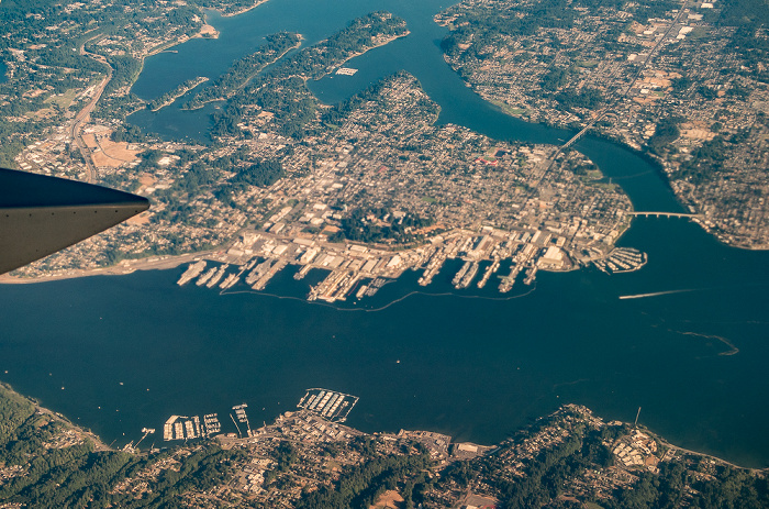
Kitsap County (v.l.): Kitsap Peninsula, Port Orchard, Bremerton
Links die Manette Bridge und die Bremerton Marina. Links oben die Port Washington Narrows, links unten das Sinclair Inlet, Flug Seattle - Honolulu. Luftbild.
| Flug DAL1195 Seattle/Tacoma (KSEA) - Daniel K Inouye Intl (PHNL) | Bremerton | Kitsap County | Kitsap Peninsula | Manette Bridge | Port Orchard | Port Washington Narrows | Sinclair Inlet |
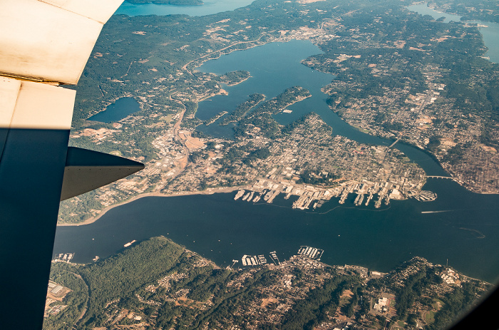
27.08.2017 | 2017 | Flug Seattle - Honolulu
Kitsap County: Kitsap Peninsula mit Bremerton, Sinclair Inlet (links unten), Port Orchard (rechts unten)
In der Bildmitte die Manette Bridge (unten), der Warren Avenue Bridge und die Bremerton Marina. Oberhalb der Bildmitte die Port Washington Narrows. Oben das Dyes Inlet. Links in der Bildmitte die Naval Station Bremerton (links) und die Puget Sound Naval Shipyard. Links unten die Port Orchard Marina. Flug Seattle - Honolulu. Luftbild.
| Flug DAL1195 Seattle/Tacoma (KSEA) - Daniel K Inouye Intl (PHNL) | Bremerton | Dyes Inlet | Kitsap County | Kitsap Peninsula | Manette Bridge | Naval Station Bremerton | Port Orchard | Port Orchard Marina | Port Washington Narrows | Puget Sound Naval Shipyard | Sinclair Inlet | Warren Avenue Bridge |
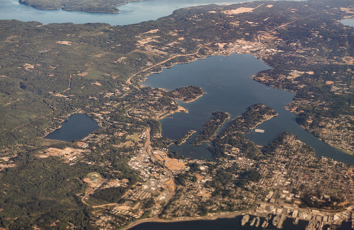
27.08.2017 | 2017 | Flug Seattle - Honolulu
Kitsap County: Kitsap Peninsula mit Bremerton, Sinclair Inlet (links unten), Port Orchard (rechts unten)
Rechts in der Bildmitte die Manette Bridge (unten), der Warren Avenue Bridge und die Bremerton Marina, darüber die Port Washington Narrows. Oben das Dyes Inlet. In der Bildmitte die Naval Station Bremerton (links) und die Puget Sound Naval Shipyard. Unten die Sinclair Inlet Marina (links) und die Port Orchard Marina. Flug Seattle - Honolulu. Luftbild.
| Flug DAL1195 Seattle/Tacoma (KSEA) - Daniel K Inouye Intl (PHNL) | Bremerton | Dyes Inlet | Kitsap County | Kitsap Peninsula | Manette Bridge | Naval Station Bremerton | Port Orchard | Port Orchard Marina | Port Washington Narrows | Puget Sound Naval Shipyard | Sinclair Inlet | Sinclair Inlet Marina | Warren Avenue Bridge |
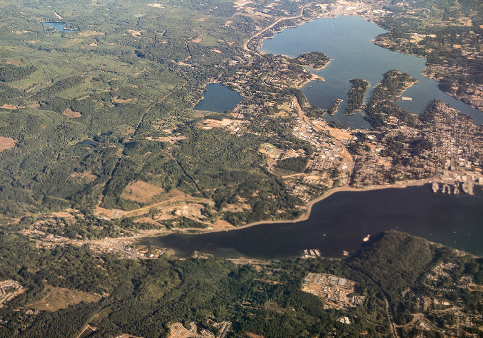
27.08.2017 | 2017 | Flug Seattle - Honolulu
Kitsap County: Kitsap Peninsula mit Bremerton, Sinclair Inlet (links unten), Port Orchard (rechts unten und rechts oben)
Rechts in der Bildmitte die Manette Bridge (unten), der Warren Avenue Bridge und die Bremerton Marina, darüber die Port Washington Narrows. Oben das Dyes Inlet. In der Bildmitte die Naval Station Bremerton (links) und die Puget Sound Naval Shipyard. Unten die Sinclair Inlet Marina (links) und die Port Orchard Marina. In der Bildmitte links der Kitsap Lake. Links oben der Hood Canal. Flug Seattle - Honolulu. Luftbild.
| Flug DAL1195 Seattle/Tacoma (KSEA) - Daniel K Inouye Intl (PHNL) | Bremerton | Dyes Inlet | Hood Canal | Kitsap County | Kitsap Lake | Kitsap Peninsula | Manette Bridge | Naval Station Bremerton | Port Orchard | Port Orchard Marina | Port Washington Narrows | Puget Sound Naval Shipyard | Sinclair Inlet | Sinclair Inlet Marina | Warren Avenue Bridge |
27.08.2017 | 2017 | Flug Seattle - Honolulu
Kitsap County: Kitsap Peninsula mit Bremerton, Sinclair Inlet (unten)
In der Bildmitte das Dyes Inlet. In der Bildmitte die Washington State Route 3 und links der Kitsap Lake. Oben der Hood Canal. Flug Seattle - Honolulu. Luftbild.
| Flug DAL1195 Seattle/Tacoma (KSEA) - Daniel K Inouye Intl (PHNL) | Bremerton | Dyes Inlet | Hood Canal | Kitsap County | Kitsap Lake | Kitsap Peninsula | Seattle | Sinclair Inlet | Washington State Route 3 |
27.08.2017 | 2017 | Flug Seattle - Honolulu
Kitsap County: Kitsap Peninsula mit Bremerton, Sinclair Inlet (unten)
Rechts oben das Dyes Inlet. In der Bildmitte die Washington State Route 3 und links der Kitsap Lake. Flug Seattle - Honolulu. Luftbild.
| Flug DAL1195 Seattle/Tacoma (KSEA) - Daniel K Inouye Intl (PHNL) | Bremerton | Dyes Inlet | Kitsap County | Kitsap Lake | Kitsap Peninsula | Sinclair Inlet | Washington State Route 3 |
27.08.2017 | 2017 | Flug Seattle - Honolulu
Kitsap County: Kitsap Peninsula mit dem Bremerton National Airport und dem Olympic View Industrial Park
Flug Seattle - Honolulu. Luftbild.
| Flug DAL1195 Seattle/Tacoma (KSEA) - Daniel K Inouye Intl (PHNL) | Bremerton National Airport | Kitsap County | Kitsap Peninsula | Olympic View Industrial Park |
27.08.2017 | 2017 | Flug Seattle - Honolulu
Kitsap County: Kitsap Peninsula mit dem Bremerton National Airport und dem Olympic View Industrial Park
Oben der Hood Canal und die Olympic Peninsula. Flug Seattle - Honolulu. Luftbild.
| Flug DAL1195 Seattle/Tacoma (KSEA) - Daniel K Inouye Intl (PHNL) | Bremerton National Airport | Hood Canal | Kitsap County | Kitsap Peninsula | Olympic Peninsula | Olympic View Industrial Park |
27.08.2017 | 2017 | Flug Seattle - Honolulu
Kitsap County: Kitsap Peninsula
Oben der Hood Canal und die Olympic Peninsula. Links unten der Inner Hood Canal. Flug Seattle - Honolulu. Luftbild.
| Flug DAL1195 Seattle/Tacoma (KSEA) - Daniel K Inouye Intl (PHNL) | Hood Canal | Inner Hood Canal | Kitsap County | Kitsap Peninsula | Olympic Peninsula |
27.08.2017 | 2017 | Flug Seattle - Honolulu
V.u. Kitsap Peninsula, Hood Canal, Olympic Peninsula mit den Olympic Mountains
Links oben Vancouver Island (Kanada). Flug Seattle - Honolulu. Luftbild.
| Flug DAL1195 Seattle/Tacoma (KSEA) - Daniel K Inouye Intl (PHNL) | Hood Canal | Kitsap County | Kitsap Peninsula | Olympic Mountains | Olympic Peninsula |
27.08.2017 | 2017 | Flug Seattle - Honolulu
Kitsap County: Kitsap Peninsula mit dem Inner Hood Canal
Oben der Hood Canal. Flug Seattle - Honolulu. Luftbild.
| Flug DAL1195 Seattle/Tacoma (KSEA) - Daniel K Inouye Intl (PHNL) | Hood Canal | Inner Hood Canal | Kitsap County | Kitsap Peninsula |
27.08.2017 | 2017 | Flug Seattle - Honolulu
Kitsap County: Kitsap Peninsula mit dem Inner Hood Canal
Oben der Hood Canal und die Olympic Peninsula mit den Olympic Mountains. Flug Seattle - Honolulu. Luftbild.
| Flug DAL1195 Seattle/Tacoma (KSEA) - Daniel K Inouye Intl (PHNL) | Hood Canal | Inner Hood Canal | Kitsap County | Kitsap Peninsula | Olympic Mountains | Olympic Peninsula |
27.08.2017 | 2017 | Flug Seattle - Honolulu
V.u. Olympic Peninsula, Inner Hood Canal, Kitsap Peninsula, Hood Canal, Olympic Peninsula mit den Olympic Mountains
Flug Seattle - Honolulu. Luftbild.
| Flug DAL1195 Seattle/Tacoma (KSEA) - Daniel K Inouye Intl (PHNL) | Hood Canal | Inner Hood Canal | Kitsap Peninsula | Olympic Mountains | Olympic Peninsula |
27.08.2017 | 2017 | Flug Seattle - Honolulu
V.u. Olympic Peninsula, Inner Hood Canal, Kitsap Peninsula, Hood Canal, Olympic Peninsula mit den Olympic Mountains
Flug Seattle - Honolulu. Luftbild.
| Flug DAL1195 Seattle/Tacoma (KSEA) - Daniel K Inouye Intl (PHNL) | Hood Canal | Inner Hood Canal | Kitsap Peninsula | Olympic Mountains | Olympic Peninsula | Seattle |
27.08.2017 | 2017 | Flug Seattle - Honolulu
Olympic Peninsula mit den Olympic Mountains
In der Bildmitte der Mount Olympus. Oben British Columbia (Kanada). Flug Seattle - Honolulu. Luftbild.
| Flug DAL1195 Seattle/Tacoma (KSEA) - Daniel K Inouye Intl (PHNL) | Mount Olympus | Olympic Mountains | Olympic Peninsula |
27.08.2017 | 2017 | Flug Seattle - Honolulu
V.u. Olympic Peninsula, Inner Hood Canal, Kitsap Peninsula, Hood Canal, Olympic Peninsula mit den Olympic Mountains
Links unten The Great Bend. Flug Seattle - Honolulu. Luftbild.
| Flug DAL1195 Seattle/Tacoma (KSEA) - Daniel K Inouye Intl (PHNL) | Hood Canal | Inner Hood Canal | Kitsap Peninsula | Olympic Mountains | Olympic Peninsula | The Great Bend |
27.08.2017 | 2017 | Flug Seattle - Honolulu
V.u. Olympic Peninsula, Annas Bay, The Great Bend, Hood Canal, Kitsap Peninsula
Rechts der Inner Hood Canal. Flug Seattle - Honolulu. Luftbild.
| Flug DAL1195 Seattle/Tacoma (KSEA) - Daniel K Inouye Intl (PHNL) | Annas Bay | Hood Canal | Inner Hood Canal | Kitsap Peninsula | Olympic Peninsula | The Great Bend |
27.08.2017 | 2017 | Flug Seattle - Honolulu
Mason County: Olympic Peninsula mit The Ridge Motorsports Park
Flug Seattle - Honolulu. Luftbild.
| Flug DAL1195 Seattle/Tacoma (KSEA) - Daniel K Inouye Intl (PHNL) | Mason County | Olympic Peninsula | Seattle | The Ridge Motorsports Park |
27.08.2017 | 2017 | Flug Seattle - Honolulu
V.u. Olympic Peninsula, Annas Bay, The Great Bend, Hood Canal, Kitsap Peninsula
In der Bildmitte der Lake Cushman, darüber die Olympic Mountains. Rechts der Inner Hood Canal. Flug Seattle - Honolulu. Luftbild.
| Flug DAL1195 Seattle/Tacoma (KSEA) - Daniel K Inouye Intl (PHNL) | Annas Bay | Hood Canal | Inner Hood Canal | Kitsap Peninsula | Lake Cushman | Olympic Mountains | Olympic Peninsula | The Great Bend |
27.08.2017 | 2017 | Flug Seattle - Honolulu
Olympic Peninsula
Rechts von der Bildmitte der Lake Cushman, darüber die Olympic Mountains. Rechts oben der Hood Canal und die Kitsap Peninsula. Flug Seattle - Honolulu. Luftbild.
| Flug DAL1195 Seattle/Tacoma (KSEA) - Daniel K Inouye Intl (PHNL) | Hood Canal | Kitsap Peninsula | Lake Cushman | Olympic Mountains | Olympic Peninsula |
27.08.2017 | 2017 | Flug Seattle - Honolulu
Olympic Peninsula mit den Olympic Mountains
Oben British Columbia (Kanada). Flug Seattle - Honolulu. Luftbild.
| Flug DAL1195 Seattle/Tacoma (KSEA) - Daniel K Inouye Intl (PHNL) | Olympic Mountains | Olympic Peninsula |
27.08.2017 | 2017 | Flug Seattle - Honolulu
Olympic Peninsula mit den Olympic Mountains
Oberhalb der Bildmitte der Wynoochee Lake. Flug Seattle - Honolulu. Luftbild.
| Flug DAL1195 Seattle/Tacoma (KSEA) - Daniel K Inouye Intl (PHNL) | Olympic Mountains | Olympic Peninsula | Wynoochee Lake |
27.08.2017 | 2017 | Flug Seattle - Honolulu
Olympic Peninsula mit den Olympic Mountains
In der Bildmitte links der Lake Quinault. Oben British Columbia (Kanada) mit Vancouver Island (links). Flug Seattle - Honolulu. Luftbild.
| Flug DAL1195 Seattle/Tacoma (KSEA) - Daniel K Inouye Intl (PHNL) | Lake Quinault | Olympic Mountains | Olympic Peninsula |
27.08.2017 | 2017 | Flug Seattle - Honolulu
Olympic Peninsula mit dem Failor Lake
Flug Seattle - Honolulu. Luftbild.
| Flug DAL1195 Seattle/Tacoma (KSEA) - Daniel K Inouye Intl (PHNL) | Failor Lake | Olympic Peninsula |
27.08.2017 | 2017 | Flug Seattle - Honolulu
Olympic Peninsula
Flug Seattle - Honolulu. Luftbild.
| Flug DAL1195 Seattle/Tacoma (KSEA) - Daniel K Inouye Intl (PHNL) | Olympic Peninsula |
27.08.2017 | 2017 | Flug Seattle - Honolulu
Pazifik, Olympic Peninsula mit dem Seashore Conservation Area State Park
Flug Seattle - Honolulu. Luftbild.
| Flug DAL1195 Seattle/Tacoma (KSEA) - Daniel K Inouye Intl (PHNL) | Olympic Peninsula | Seashore Conservation Area State Park |
27.08.2017 | 2017 | Flug Seattle - Honolulu
Pazifik, Olympic Peninsula mit dem Seashore Conservation Area State Park
Flug Seattle - Honolulu. Luftbild.
| Flug DAL1195 Seattle/Tacoma (KSEA) - Daniel K Inouye Intl (PHNL) | Olympic Peninsula | Seashore Conservation Area State Park |
27.08.2017 | 2017 | Flug Seattle - Honolulu
Pazifik, Olympic Peninsula mit dem Seashore Conservation Area State Park
Flug Seattle - Honolulu. Luftbild.
| Flug DAL1195 Seattle/Tacoma (KSEA) - Daniel K Inouye Intl (PHNL) | Olympic Peninsula | Seashore Conservation Area State Park |
27.08.2017 | 2017 | Flug Seattle - Honolulu
Pazifik, Olympic Peninsula mit dem Seashore Conservation Area State Park
Flug Seattle - Honolulu. Luftbild.
| Flug DAL1195 Seattle/Tacoma (KSEA) - Daniel K Inouye Intl (PHNL) | Olympic Peninsula | Seashore Conservation Area State Park |
- Agate Passage
- Andrews Bay
- Annas Bay
- Auburn
- Bainbridge Island
- Balmer Yard
- Beaver Lake
- Bellevue
- Benton County
- Boeing Auburn Site
- Boeing Field
- Bonney Lake
- Bremerton
- Bremerton National Airport
- Buckley
- Cascade Range (Kaskadenkette)
- Cle Elum Lake
- Columbia River
- Corliss Resources
- Des Moines
- Discovery Park
- Duwamish River
- Dyes Inlet
- Eagle Harbor
- East Passage
- Edgewood
- Enchanted Parkway South
- Enumclaw
- Evergreen Point Floating Bridge
- Failor Lake
- Federal Way
- Five Mile Lake
- Franklin County
- Glacier Peak
- Goose Island
- Grant County
- Green Lake
- Henry M. Jackson Wilderness
- Homer M. Hadley Memorial Bridge
- Hood Canal
- Howard A Hanson Reservoir
- Inner Hood Canal
- Interbay Athletic Complex
- Interstate I-5
- Interstate I-90 (American Veterans Memorial Highway)
- Issaquah
- Jay Lake
- Kachess Lake
- Keechelus Lake
- Kennewick
- King County
- Kitsap County
- Kitsap Lake
- Kitsap Peninsula
- Kittitas County
- Lake Cushman
- Lake Dolloff
- Lake Geneva
- Lake Killarney
- Lake Quinault
- Lake Sammamish
- Lake Tapps
- Lake Union
- Lake Washington
- Lake Washington Ship Canal
- Lakeland North
- Lakeland South
- Lynn Lake
- Manette Bridge
- Mason County
- Masonic Home of Washington
- Mercer Island
- Meydenbauer Bay
- Montlake Cut
- Mount Baker
- Mount Baker Ridge Tunnel
- Mount Olympus
- Mount Rainier
- Mount Shuksan
- Naches
- Naches River
- Naval Station Bremerton
- North Lake
- Olympic Mountains
- Olympic Peninsula
- Olympic View Industrial Park
- Pacific
- Pasco
- Pierce County
- Pine Lake
- Port Madison
- Port of Seattle Fishermen's Terminal
- Port Orchard
- Port Orchard Marina
- Port Washington Narrows
- Portage Bay
- Priest Rapids Dam
- Priest Rapids Wildlife Area
- Puget Sound
- Puget Sound Naval Shipyard
- Puyallup River
- Richland
- Sammamish
- Seashore Conservation Area State Park
- Seattle
- Selah
- Seward Park
- Shaw Lake
- Shilshole Bay
- Shilshole Bay Marina
- Ship Canal Bridge
- Sinclair Inlet
- Sinclair Inlet Marina
- Skykomish River
- South Fork McSorley Creek
- Spada Lake
- Steel Lake
- Sumner
- Surprise Lake
- The Great Bend
- The Ridge Motorsports Park
- Trout Lake
- Tukwila
- Tukwila Commerce Park
- Umtanum Creek
- University Bridge
- Wallace Falls State Park
- Wallace Lake
- Warren Avenue Bridge
- Washington State Route 167 (Valley Freeway)
- Washington State Route 18
- Washington State Route 3
- Washington State Route 410
- Washington State Route 520
- Washington State Route 599
- Weyerhaeuser Wood Products Laboratory
- White River
- Woodland Park
- Wynoochee Lake
- Yakima County
- Yakima River
- Zirkle Fruit Company